Area Overview for Macclesfield Tytherington Ward
Photos of Macclesfield Tytherington Ward

Area Information
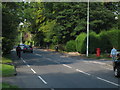
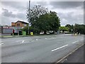
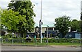
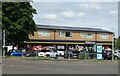
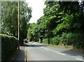
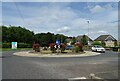
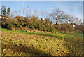
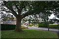
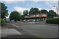
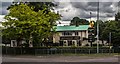
Living in Macclesfield Tytherington Ward offers a defined residential experience within the Cheshire unitary authority. This ward covers an area of just 3.6 square kilometres, creating a compact yet established district. The location sits within Macclesfield, providing close proximity to wider town centres while maintaining a distinct local character. Residents here experience a neighbourhood designed for settled living rather than transient change. The compact footprint ensures that daily routes are short, and the built environment reflects a long history of habitation. You will find that life in this ward is paced by the rhythms of a mature community rather than the frantic energy of a commercial zone. The district functions as a self-contained part of Macclesfield where local interactions remain consistent over time. Your daily commute or family walks traverse a familiar landscape that has evolved steadily. The physical boundaries are clear, yet the connection to the rest of the borough remains strong. This area serves as a stable base for those who prioritise predictability in their surroundings.
- Area Type
- District Borough Unitary Ward
- Area Size
- 3.6 km²
- Population
- Not available
- Population Density
- Not available
Demographics
The community profile in Macclesfield Tytherington Ward reveals a population skewed significantly towards older demographics. The median age stands at 70 years, indicating that most residents are retired or elderly. This age distribution shapes the local infrastructure and social needs of the ward. You will primarily encounter households composed of seniors rather than young families or students. Home ownership is the dominant tenure model, with 83% of residents owning their homes outright or with a mortgage. This high ownership rate creates a community invested in the long-term stability of Macclesfield Tytherington Ward. Accommodation types generally reflect the needs of an older population, though specific figures on flat versus house ratios are not detailed in this dataset. The neighbourhood lacks data on predominant ethnic groups or religious affiliations, but the social fabric is defined by its age cohort. Deprivation metrics are not available for this specific ward in the current records. Despite the absence of detailed deprivation data, the high home ownership suggests a secure financial standing among occupants. You should expect a quiet, settled environment where neighbours know each other over decades of residence.
Household Size
Accommodation Type
Tenure
Ethnic Group
Religion
Household Composition
Age
Household Deprivation
NS-SEC
Explore more demographic insights in this area
Go to Demographics tabPlanning
Planning Constraints
- Flood RiskPremium
- Ramsar Wetland SitesPremium
- Area of Outstanding Natural BeautyPremium
- Protected Nature ReservePremium
- Protected WoodlandPremium
- Crime RiskPremium