Area Overview for Macclesfield Hurdsfield Ward
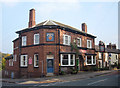
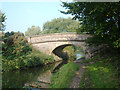
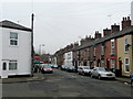
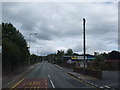
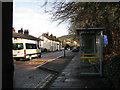
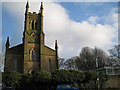
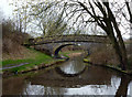
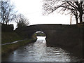
Photos of Macclesfield Hurdsfield Ward
Area Information
Macclesfield Hurdsfield Ward is a distinct electoral ward situated within the Cheshire East unitary authority. It occupies the north-eastern part of Cheshire East and falls entirely within the modern town of Macclesfield. The local area covers a compact footprint of 1.7 km², making it a small but defined community unit. This ward forms part of the broader Macclesfield UK Parliament constituency, positioning it within a well-established parliamentary boundary. Living in Macclesfield Hurdsfield Ward means residing in a specific slice of the larger town where local administration and national representation intersect. The location coordinates place it at approximately 53.2692°N and 2.1151°W, confirming its fixed position in North West England. Prospective buyers should view this ward as a recognizable piece of the Macclesfield landscape rather than a remote village. The area integrates seamlessly into the administrative structure of Cheshire East while maintaining its identity as a ward within the Macclesfield town boundary. Daily life here involves navigating a smaller, contained environment that feeds into the wider town infrastructure. The ward profile is available from the council for those researching the specific administrative details. Understanding that this is a unitary ward helps clarify how local services are delivered and how the area relates to the surrounding districts. It is a practical choice for residents seeking a defined local area within the functional town of Macclesfield.
- Area Type
- District Borough Unitary Ward
- Area Size
- 1.7 km²
- Population
- Not available
- Population Density
- Not available
Demographics
Community composition in Macclesfield Hurdsfield Ward reflects a mature population with significant implications for neighbourhood dynamics. The median age stands at 70 years, marking this area as one of the older electoral wards in the region. This age profile suggests a community where retirees and older families form the core demographic. Consequently, local services and social activities likely cater to the needs of an older population base. Ownership patterns indicate that 55% of residents own their homes outright or with a mortgage. This majority ownership rate points to a stable, settled community where long-term residents represent a significant portion of the population. Household composition data categorises the total makeup without specifying detailed breakdowns beyond the aggregate. Accommodation types also reflect the total housing stock rather than highlighting specific class distinctions or unique architectural styles within the ward. The demographic picture lacks detailed statistics on ethnic diversity, religious affiliation, or specific household breakdowns beyond the age average. Without specific figures on minority groups or family structures, the overall tapestry remains defined by its age distribution and ownership stability. Deprivation levels are not explicitly quantified in the available profiles for this specific ward, so quality of life impacts must be inferred from the age profile and ownership rates. The absence of granular diversity data limits the depth of the social profile but does not detract from the clear picture of an area dominated by older homeowners.
Household Size
Accommodation Type
Tenure
Ethnic Group
Religion
Household Composition
Age
Household Deprivation
NS-SEC
Explore more demographic insights in this area
Go to Demographics tabPlanning
Planning Constraints
- Flood RiskPremium
- Ramsar Wetland SitesPremium
- Area of Outstanding Natural BeautyPremium
- Protected Nature ReservePremium
- Protected WoodlandPremium
- Crime RiskPremium