Area Overview for M9 8EU
Photos of M9 8EU
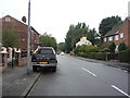
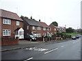
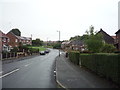
35 photos from this area
Area Information
Key information about the M9 8EU including its size, population, and administrative classification.
- Area Type
- Postcode
- Area Size
- 1.9 hectares
- Population
- 1974
- Population Density
- 579 people/km²
House Prices in M9 8EU
20
Properties
£171,278
Average Sold Price
£44,500
Lowest Price
£310,000
Highest Price
Showing 20 properties
| Address | Type | Beds | Baths | Last Sale Price | Last Sale Date | |
|---|---|---|---|---|---|---|
| 23 Ellbourne Road, Manchester, M9 8EU | Detached | 3 | 1 | £225,000 | Feb 2025 | |
| 11 Ellbourne Road, Manchester, M9 8EU | Detached | 3 | 2 | £310,000 | Aug 2023 | |
| 7 Ellbourne Road, Manchester, M9 8EU | Retail | 3 | 1 | £280,000 | Sep 2022 | |
| 6 Ellbourne Road, Manchester, M9 8EU | house | - | - | £205,000 | Jul 2022 | |
| 15 Ellbourne Road, Manchester, M9 8EU | house | - | - | £292,000 | Jul 2021 | |
| 8 Ellbourne Road, Manchester, M9 8EU | house | 8 | - | £147,000 | Mar 2017 | |
| 9 Ellbourne Road, Manchester, M9 8EU | Detached | 3 | 1 | £155,000 | Jan 2017 | |
| 3 Ellbourne Road, Manchester, M9 8EU | house | - | - | £190,950 | Dec 2016 | |
| 19 Ellbourne Road, Manchester, M9 8EU | house | - | - | £120,000 | Jun 2016 | |
| 25 Ellbourne Road, Manchester, M9 8EU | Detached | 3 | 1 | £180,000 | Jun 2016 |
Page 1 of 2
Energy Efficiency in M9 8EU
Amenities
Schools
| Rank | School | Type | Entry gender | Ages |
|---|
Explore more schools in this area
Go to Schools tabDemographics
Household Size
Family (3-5 people)
most common
Accommodation Type
Houses
most common
Tenure
59
majority
Ethnic Group
asian_total
most common
Religion
N/A
most common
Household Composition
N/A
most common
Age
47
median
Adults (30-64 years)
most common
Household Deprivation
N/A
with no deprivation
NS-SEC
24
in Lower managerial occupations
Explore more demographic insights in this area
Go to Demographics tabPlanning
Planning Constraints
- Flood RiskPremium
- Ramsar Wetland SitesPremium
- Area of Outstanding Natural BeautyPremium
- Protected Nature ReservePremium
- Protected WoodlandPremium