Area Overview for M9 7AJ
Photos of M9 7AJ
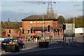
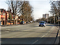
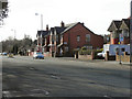
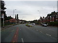

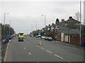
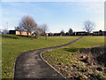
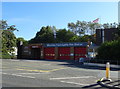
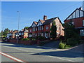
27 photos from this area
Area Information
Key information about the M9 7AJ including its size, population, and administrative classification.
- Area Type
- Postcode
- Area Size
- 2.8 hectares
- Population
- 1966
- Population Density
- 5530 people/km²
House Prices in M9 7AJ
56
Properties
£97,605
Average Sold Price
£16,750
Lowest Price
£255,000
Highest Price
Showing 56 properties
| Address | Type | Beds | Baths | Last Sale Price | Last Sale Date | |
|---|---|---|---|---|---|---|
| 21 Grange Drive, Manchester, M9 7AJ | Semi-detached | 3 | 1 | £163,000 | Mar 2025 | |
| 81 Grange Drive, Manchester, M9 7AJ | Terraced | 3 | 1 | £205,000 | Feb 2025 | |
| 55 Grange Drive, Manchester, M9 7AJ | Terraced | 3 | 1 | £255,000 | Feb 2025 | |
| 65 Grange Drive, Manchester, M9 7AJ | Semi-detached | 3 | 1 | £155,000 | Nov 2023 | |
| 61 Grange Drive, Manchester, M9 7AJ | house | 3 | 1 | £175,000 | May 2023 | |
| 43 Grange Drive, Manchester, M9 7AJ | house | 2 | 1 | £132,000 | Nov 2022 | |
| 25 Grange Drive, Manchester, M9 7AJ | house | - | - | £139,000 | Aug 2022 | |
| 71 Grange Drive, Manchester, M9 7AJ | Semi-detached | 2 | 1 | £125,500 | Jul 2021 | |
| 73 Grange Drive, Manchester, M9 7AJ | house | - | - | £111,786 | May 2021 | |
| 35 Grange Drive, Manchester, M9 7AJ | house | - | - | £170,000 | Oct 2020 |
Page 1 of 6
Energy Efficiency in M9 7AJ
Amenities
Schools
| Rank | School | Type | Entry gender | Ages |
|---|
Explore more schools in this area
Go to Schools tabDemographics
Household Size
Family (3-5 people)
most common
Accommodation Type
Houses
most common
Tenure
57
majority
Ethnic Group
White
most common
Religion
N/A
most common
Household Composition
N/A
most common
Age
47
median
Adults (30-64 years)
most common
Household Deprivation
N/A
with no deprivation
NS-SEC
25
in Lower managerial occupations
Explore more demographic insights in this area
Go to Demographics tabPlanning
Planning Constraints
- Flood RiskPremium
- Ramsar Wetland SitesPremium
- Area of Outstanding Natural BeautyPremium
- Protected Nature ReservePremium
- Protected WoodlandPremium