Area Overview for M9 6RA
Photos of M9 6RA
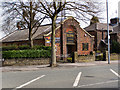


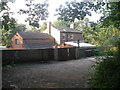
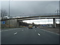

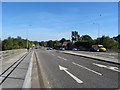

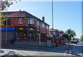
24 photos from this area
Area Information
Key information about the M9 6RA including its size, population, and administrative classification.
- Area Type
- Postcode
- Area Size
- 8224 m²
- Population
- 1866
- Population Density
- 6415 people/km²
House Prices in M9 6RA
11
Properties
£128,200
Average Sold Price
£49,000
Lowest Price
£205,000
Highest Price
Showing 11 properties
| Address | Type | Beds | Baths | Last Sale Price | Last Sale Date | |
|---|---|---|---|---|---|---|
| 39 Victoria Avenue, Blackley, Manchester, M9 6RA | Detached | 3 | 1 | £205,000 | Aug 2021 | |
| 41 Victoria Avenue, Blackley, Manchester, M9 6RA | Detached | 3 | 1 | £168,000 | May 2018 | |
| 43 Victoria Avenue, Blackley, Manchester, M9 6RA | Detached | 3 | 1 | £109,000 | Jan 2017 | |
| 45 Victoria Avenue, Blackley, Manchester, M9 6RA | Detached | 3 | 1 | £110,000 | Oct 2005 | |
| 37 Victoria Avenue, Blackley, Manchester, M9 6RA | Detached | 3 | 1 | £49,000 | Jul 1999 | |
| 55 Victoria Avenue, Blackley, Manchester, M9 6RA | Detached | - | - | - | - | |
| 9A Victoria Avenue, Blackley, Manchester, M9 6RA | Flat | - | - | - | - | |
| 47 Victoria Avenue, Blackley, Manchester, M9 6RA | house | - | - | - | - | |
| 49 Victoria Avenue, Blackley, Manchester, M9 6RA | Detached | - | - | - | - | |
| Body Glo, 7A Victoria Avenue, Blackley, Manchester, M9 6RA | retail_financial | - | - | - | - |
Page 1 of 2
Energy Efficiency in M9 6RA
Amenities
Schools
| Rank | School | Type | Entry gender | Ages |
|---|
Explore more schools in this area
Go to Schools tabDemographics
Household Size
Family (3-5 people)
most common
Accommodation Type
Houses
most common
Tenure
40
majority
Ethnic Group
White
most common
Religion
N/A
most common
Household Composition
N/A
most common
Age
47
median
Adults (30-64 years)
most common
Household Deprivation
N/A
with no deprivation
NS-SEC
15
in Lower managerial occupations
Explore more demographic insights in this area
Go to Demographics tabPlanning
Planning Constraints
- Flood RiskPremium
- Ramsar Wetland SitesPremium
- Area of Outstanding Natural BeautyPremium
- Protected Nature ReservePremium
- Protected WoodlandPremium