Area Overview for M9 4RN
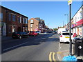
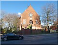
Photos of M9 4RN


Area Information
Living in M9 4RN offers a compact residential experience within a small cluster of homes, catering to a population of 2,383 residents. The area is characterised by its focus on single-family dwellings, with houses forming the predominant accommodation type. This small postcode area is positioned near a range of essential services, including retail outlets, public transport hubs, and schools. The community is primarily composed of adults aged 30–64, reflecting a mature demographic profile. Daily life here is shaped by proximity to multiple rail and metro stations, ensuring easy access to nearby urban centres. While the broadband connectivity score of 90 indicates excellent internet quality, the area’s high crime risk score of 0 highlights a pressing need for security awareness. For those seeking a quiet residential setting with practical amenities, M9 4RN provides a blend of convenience and accessibility, though buyers should consider the safety context when evaluating the area.
- Area Type
- Postcode
- Area Size
- Not available
- Population
- 2383
- Population Density
- 2922 people/km²
The property market in M9 4RN is defined by its low home ownership rate of 19%, indicating that the majority of properties are rented rather than owner-occupied. This suggests a rental-focused market, which may affect the availability of long-term buy-to-let opportunities. The accommodation type is predominantly houses, which is uncommon in many urban areas but aligns with the small, residential character of the postcode. The limited number of properties in this area means the housing stock is constrained, potentially leading to competition among buyers. For those considering purchase, the market’s small scale and focus on rental properties may require a strategic approach, such as targeting specific property types or locations within the area. The predominance of houses also means that buyers should be prepared for larger, less densely packed homes compared to other urban postcode areas.
House Prices in M9 4RN
No properties found in this postcode.
Energy Efficiency in M9 4RN
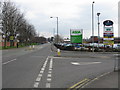
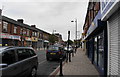
Residents of M9 4RN have access to a range of amenities within practical reach, including retail outlets such as Lidl Blackley, Asda Harpurhey, and Farmfoods Blackley, which provide everyday shopping needs. The area’s transport infrastructure is well-developed, with multiple rail and metro stations offering connections to nearby hubs. While the data does not specify parks or leisure facilities, the presence of multiple transport options and retail venues suggests a lifestyle focused on convenience and accessibility. The proximity to schools and transport links enhances the area’s appeal for families and commuters. However, the lack of detailed information on recreational spaces means that buyers should investigate further for insights into local leisure opportunities. Overall, the area’s amenities support a practical, commuter-oriented lifestyle with strong retail and transport links.
Amenities
Schools
Residents of M9 4RN have access to two primary schools: Burgess Primary School and Moston Brook High School, both of which cater to younger children. The presence of two primary schools within practical reach provides families with options for early education, though no secondary schools are listed in the data. This suggests that students may need to travel to nearby areas for secondary education. The availability of primary schools is a key consideration for families prioritising proximity to educational institutions. However, the absence of secondary school options within the immediate vicinity means that parents should investigate commuting routes or alternative schooling arrangements. The mix of school types reflects a focus on early education, which could be a draw for families with young children but may require additional planning for older students.
| Rank | School | Type | Entry gender | Ages |
|---|
Explore more schools in this area
Go to Schools tabDemographics
The population of M9 4RN is 2,383, with a median age of 47, indicating a mature community where the majority of residents fall within the 30–64 age range. Home ownership is relatively low at 19%, suggesting that the area is more rental-focused than owner-occupied. The accommodation type is predominantly houses, which is unusual for urban areas but aligns with the small, residential nature of the postcode. The predominant ethnic group is White, with no specific data provided on other demographics. This age profile and ownership pattern suggest a community of established residents, many of whom may be retired or in later career stages. The low home ownership rate could influence local property dynamics, potentially limiting long-term investment opportunities for buyers. The demographic profile also implies a stable, low-turnover environment, which may appeal to those seeking a settled lifestyle.
Household Size
Accommodation Type
Tenure
Ethnic Group
Religion
Household Composition
Age
Household Deprivation
NS-SEC
Explore more demographic insights in this area
Go to Demographics tabPlanning
Planning Constraints
- Flood RiskPremium
- Ramsar Wetland SitesPremium
- Area of Outstanding Natural BeautyPremium
- Protected Nature ReservePremium
- Protected WoodlandPremium