Area Overview for M9 4DJ
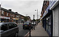
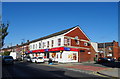
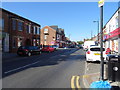
Photos of M9 4DJ


Area Information
Living in M9 4DJ means being part of a small, densely populated residential cluster in England. The area covers 6,643 square metres and is home to 2,193 people, resulting in a population density of 330,111 people per square kilometre. This compact community is characterised by its proximity to essential services and transport links, making daily life efficient. The area’s mix of schools, retail outlets, and public transport options supports a practical, accessible lifestyle. While the high population density suggests a tightly knit environment, the area’s small size means residents are likely to know their neighbours. M9 4DJ is not a sprawling suburb but a focused residential zone, with homes primarily in the form of houses. Its location near multiple rail and metro stations, along with nearby shops and amenities, positions it as a convenient spot for those prioritising connectivity and proximity to urban hubs.
- Area Type
- Postcode
- Area Size
- 6643 m²
- Population
- 2193
- Population Density
- 4728 people/km²
The property market in M9 4DJ is characterised by a low home ownership rate of 22%, suggesting that the area is more rental-focused than owner-occupied. The predominant accommodation type is houses, which may indicate a mix of older, family-friendly properties or specific housing developments. Given the area’s small size and high population density, the housing stock is likely limited, with fewer new builds or large-scale developments. For buyers, this means a competitive market with limited options, particularly for those seeking owner-occupied homes. The focus on houses may also imply that properties are older or have unique features, which could appeal to buyers looking for character or space. However, the low home ownership rate suggests that rental demand is strong, potentially influencing property values and availability.
House Prices in M9 4DJ
No properties found in this postcode.
Energy Efficiency in M9 4DJ
Residents of M9 4DJ have access to a range of amenities within practical reach. Retail options include Asda Harpurhey, Farmfoods Blackley, and Lidl Blackley, providing convenience for daily shopping. The area’s proximity to metro and rail stations, such as Monsall Station and Salford Central Railway Station, ensures easy access to broader urban networks. While the bus network is limited to one stop at Chorlton Street Coach Station, the variety of transport options enhances mobility. The presence of multiple retail and transport hubs suggests a functional, service-oriented lifestyle, where residents can meet daily needs without long commutes. The compact nature of the area means amenities are closely clustered, supporting a practical, accessible way of life.
Amenities
Schools
Residents of M9 4DJ have access to a range of school options, including Holy Trinity CofE Primary School, which holds an Ofsted rating of satisfactory, and Mount Carmel RC Infant School, a primary institution. For independent education, TLG Manchester offers an alternative, while the Manchester Alternative Provision Academy caters to other educational needs. This mix of state and independent schools provides families with choices, though the limited number of schools suggests that proximity to specific institutions may be a factor in decision-making. The presence of both primary and specialist schools indicates that the area supports diverse educational pathways, though the absence of secondary school data means families may need to consider nearby districts for comprehensive schooling.
| Rank | School | Type | Entry gender | Ages |
|---|
Explore more schools in this area
Go to Schools tabDemographics
The community in M9 4DJ is predominantly composed of adults aged 30–64, with a median age of 47. This suggests a mature, established population, likely with long-term ties to the area. Home ownership rates are low at 22%, indicating that a significant portion of residents are renters. The accommodation type is primarily houses, which may reflect the area’s older housing stock or specific planning constraints. The predominant ethnic group is White, though no data on diversity or deprivation is provided. The age profile and home ownership figures suggest a community that may be more transient than owner-occupied areas, with residents potentially prioritising proximity to services over long-term investment in property.
Household Size
Accommodation Type
Tenure
Ethnic Group
Religion
Household Composition
Age
Household Deprivation
NS-SEC
Explore more demographic insights in this area
Go to Demographics tabPlanning
Planning Constraints
- Flood RiskPremium
- Ramsar Wetland SitesPremium
- Area of Outstanding Natural BeautyPremium
- Protected Nature ReservePremium
- Protected WoodlandPremium