Area Overview for M8 9LL
Photos of M8 9LL
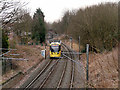
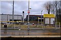
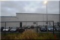
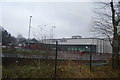
67 photos from this area
Area Information
Key information about the M8 9LL including its size, population, and administrative classification.
- Area Type
- Postcode
- Area Size
- 9478 m²
- Population
- 2293
- Population Density
- 8374 people/km²
House Prices in M8 9LL
37
Properties
£91,543
Average Sold Price
£23,180
Lowest Price
£145,000
Highest Price
Showing 37 properties
| Address | Type | Beds | Baths | Last Sale Price | Last Sale Date | |
|---|---|---|---|---|---|---|
| 20 Woodlands Street, Manchester, M8 9LL | house | - | - | £145,000 | Sep 2023 | |
| 8 Woodlands Street, Manchester, M8 9LL | Terraced | 4 | 3 | £120,000 | Jun 2021 | |
| 22 Woodlands Street, Manchester, M8 9LL | house | - | - | £102,000 | Feb 2019 | |
| 16 Woodlands Street, Manchester, M8 9LL | house | - | - | £130,000 | Dec 2015 | |
| 4 Woodlands Street, Manchester, M8 9LL | house | 4 | - | £130,000 | Jan 2013 | |
| 32 Woodlands Street, Manchester, M8 9LL | house | - | - | £86,250 | Aug 2012 | |
| 6 Woodlands Street, Manchester, M8 9LL | Terraced | 4 | 1 | £100,000 | Aug 2005 | |
| 34 Woodlands Street, Manchester, M8 9LL | house | - | - | £36,000 | Sep 2000 | |
| 2 Woodlands Street, Manchester, M8 9LL | Flat | - | - | £43,000 | May 2000 | |
| 30 Woodlands Street, Manchester, M8 9LL | house | - | - | £23,180 | Mar 1996 |
Page 1 of 4
Energy Efficiency in M8 9LL
Amenities
Schools
| Rank | School | Type | Entry gender | Ages |
|---|
Explore more schools in this area
Go to Schools tabDemographics
Household Size
Family (3-5 people)
most common
Accommodation Type
Houses
most common
Tenure
19
majority
Ethnic Group
asian_total
most common
Religion
N/A
most common
Household Composition
N/A
most common
Age
22
median
Adults (30-64 years)
most common
Household Deprivation
N/A
with no deprivation
NS-SEC
12
in Lower managerial occupations
Explore more demographic insights in this area
Go to Demographics tabPlanning
Planning Constraints
- Flood RiskPremium
- Ramsar Wetland SitesPremium
- Area of Outstanding Natural BeautyPremium
- Protected Nature ReservePremium
- Protected WoodlandPremium