Area Overview for M8 8BE
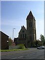
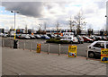
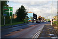
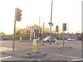
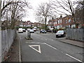
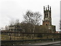
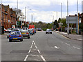
Photos of M8 8BE


Area Information
Living in M8 8BE means being part of a tightly knit residential cluster in England, home to 2,783 people. This small area is defined by its proximity to key transport hubs and a mix of retail and educational facilities. The community is predominantly composed of adults aged 30–64, with a median age of 22, suggesting a blend of families and young professionals. While the area has no protected natural sites or flood risks, it faces a critical challenge: crime rates are above average, with a safety score of 0/100. Despite this, residents benefit from excellent broadband connectivity (93/100) and strong rail links, including Salford Central and Manchester Oxford Road stations. Nearby, St Chad’s RC Primary School and Manchester Salafi School offer a range of educational options. Daily life here balances convenience—think Lidl Manchester and Asda Living—against the need for heightened security measures. For those seeking a compact, connected neighbourhood with accessible amenities, M8 8BE presents a distinct, if complex, proposition.
- Area Type
- Postcode
- Area Size
- Not available
- Population
- 2783
- Population Density
- 4979 people/km²
The property market in M8 8BE is characterised by a low home ownership rate of 21%, suggesting that most residents rent rather than own their homes. This could indicate a limited supply of available properties or a preference for rental housing in the area. The accommodation type is primarily houses, which may imply a focus on family-sized homes or older properties. Given the area’s small size, the housing stock is likely constrained, potentially limiting options for buyers. The high crime risk—above average—may also affect property desirability, with some buyers prioritising security over location. For those considering the area, the proximity to rail and metro stations, including Salford Central and Manchester Oxford Road, could offset concerns about safety. However, the lack of protected natural sites or planning constraints means developers have more flexibility, though the market remains niche due to the postcode’s compact nature.
House Prices in M8 8BE
No properties found in this postcode.
Energy Efficiency in M8 8BE
The lifestyle in M8 8BE is shaped by its proximity to retail, transport, and educational hubs. Residents have access to five retail venues, including Lidl Manchester and Asda Living, ensuring everyday shopping needs are met. The area’s transport links are extensive, with five metro stops, five rail stations, and a bus station providing connectivity to nearby towns and cities. Parks or green spaces are not explicitly listed, but the absence of protected natural sites suggests limited recreational areas. For leisure, the mix of retail and transport options allows for a dynamic daily routine, from shopping to commuting. The presence of schools and community-focused amenities fosters a sense of local identity. However, the lack of detailed information on parks or cultural venues means residents may need to travel further for recreational activities. Overall, the area’s lifestyle balances practicality with the challenges of limited green spaces and high crime risk.
Amenities
Schools
Residents of M8 8BE have access to three schools, each offering different educational pathways. St Chad’s RC Primary School and St Chad’s Roman Catholic Primary School, a Voluntary Academy, both provide primary education, with the latter holding an Ofsted rating of satisfactory. Manchester Salafi School, an independent institution, offers an alternative to state-funded education. The mix of state and independent schools gives families options, though the independent school may cater to specific religious or cultural preferences. The presence of two primary schools within the area suggests a focus on early education, but no secondary schools are listed. For families prioritising school quality, the Ofsted rating of one primary school provides a benchmark, while the independent school may require higher financial commitment. The overall school landscape reflects the area’s demographic composition and community priorities.
| Rank | School | Type | Entry gender | Ages |
|---|
Explore more schools in this area
Go to Schools tabDemographics
M8 8BE’s population of 2,783 is predominantly composed of adults aged 30–64, with a median age of 22. This suggests a community skewed toward older households, possibly including retirees or long-term residents. Only 21% of homes are owner-occupied, indicating a rental-heavy market, which may reflect the area’s smaller size and limited housing stock. The accommodation type is primarily houses, though the exact number of households or family structures is not specified. The predominant ethnic group is Asian_total, shaping the cultural and social dynamics of the area. While no deprivation data is provided, the low home ownership rate and high crime risk—above average—may influence quality of life, particularly for those prioritising security and stability. The mix of age groups and household types creates a diverse but tightly focused community, with limited scope for expansion or new developments.
Household Size
Accommodation Type
Tenure
Ethnic Group
Religion
Household Composition
Age
Household Deprivation
NS-SEC
Explore more demographic insights in this area
Go to Demographics tabPlanning
Planning Constraints
- Flood RiskPremium
- Ramsar Wetland SitesPremium
- Area of Outstanding Natural BeautyPremium
- Protected Nature ReservePremium
- Protected WoodlandPremium