Area Overview for M8 7FL
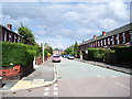
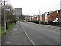
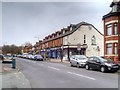
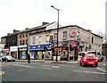
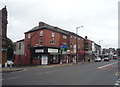
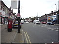
Photos of M8 7FL


Area Information
Living in M8 7FL means being part of a small, tightly knit residential cluster in England, home to 2,698 people. This postcode area is characterised by its modest scale, with homes predominantly in the form of individual houses rather than apartments or high-rises. The community is skewed towards adults aged 30–64, suggesting a mix of established families and professionals. Daily life here is shaped by proximity to a range of amenities, from nearby schools and retail outlets to rail and metro links. The area’s compact nature means residents can access essential services within short distances, though the low home ownership rate of 16% indicates a rental market dominance. While the population is largely White, the data does not specify further diversity metrics. For those seeking a quiet, community-focused environment with practical connectivity, M8 7FL offers a blend of residential stability and accessibility to urban infrastructure.
- Area Type
- Postcode
- Area Size
- Not available
- Population
- 2698
- Population Density
- 9208 people/km²
The property market in M8 7FL is heavily rental-focused, with only 16% of homes owned by residents. This low ownership rate suggests a transient population, possibly driven by affordability or employment patterns. The accommodation type is predominantly houses, which is unusual for a small postcode area and may indicate a mix of semi-detached or terraced properties. For buyers, this means the area is not a traditional owner-occupied market, and properties may be more suited to those seeking long-term rental investments. The compact size of M8 7FL means the housing stock is limited, with little scope for expansion. Buyers should consider the area’s small scale and the potential for competition in a rental-dominated market, particularly if seeking a primary residence.
House Prices in M8 7FL
No properties found in this postcode.
Energy Efficiency in M8 7FL
Residents of M8 7FL benefit from a range of nearby amenities, including five retail outlets such as Asda Higher, Iceland Cheetham, and Asda Shirley, which cater to everyday shopping needs. The area’s proximity to five metro stations, including Crumpsall and Queens Road, and three rail stations like Salford Crescent, ensures easy access to urban centres. A bus stop at Chorlton Street Coach Station provides additional transport options. The nearby City Airport Manchester is within practical reach, enhancing travel convenience. While the area lacks detailed information on parks or leisure facilities, the density of retail and transport hubs suggests a lifestyle focused on practicality and connectivity, with minimal need for long commutes to access services.
Amenities
Schools
Residents of M8 7FL have access to several primary schools, including Marlborough Road Primary School, Marlborough Road Junior School, and Marlborough Road Infant School, which collectively serve the area’s younger population. St Thomas of Canterbury RC Primary School is rated outstanding by Ofsted, offering a high standard of education for local children. Bnos Yisroel School Manchester, an independent school, is rated satisfactory, providing an alternative for families seeking non-state education. The presence of both state and independent schools reflects a range of options for parents, though no secondary schools are listed. For families prioritising academic quality, the outstanding-rated school is a strong draw, while the independent option caters to specific educational preferences.
| Rank | School | Type | Entry gender | Ages |
|---|
Explore more schools in this area
Go to Schools tabDemographics
The population of M8 7FL is 2,698, with a median age of 22. This suggests a younger demographic, though the most common age range among residents is adults aged 30–64, indicating a balance between younger families and older professionals. Home ownership is exceptionally low at 16%, meaning most residents rent their properties. The area is dominated by houses rather than flats or apartments, reflecting a suburban or semi-rural character. The predominant ethnic group is White, though no further breakdown of diversity is provided. The low home ownership rate and age profile imply a transient population, possibly influenced by rental affordability or temporary employment. For quality of life, this suggests a community where long-term stability may be limited, but proximity to services and transport could offset this.
Household Size
Accommodation Type
Tenure
Ethnic Group
Religion
Household Composition
Age
Household Deprivation
NS-SEC
Explore more demographic insights in this area
Go to Demographics tabPlanning
Planning Constraints
- Flood RiskPremium
- Ramsar Wetland SitesPremium
- Area of Outstanding Natural BeautyPremium
- Protected Nature ReservePremium
- Protected WoodlandPremium