Area Overview for M8 6QD
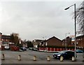
Photos of M8 6QD


Area Information
Living in M8 6QD means inhabiting a small, tightly knit residential cluster in England, home to 2142 people. This area is defined by its compact nature, with housing focused on individual properties rather than high-density developments. The community is predominantly composed of adults aged 30–64, reflecting a mature demographic with established roots. Daily life here is shaped by proximity to essential services, including five metro stations, multiple retail outlets, and accessible rail links. The area’s compact size means residents can reach key amenities within a short distance, though its small footprint also limits the diversity of local facilities. While the population is relatively modest, the presence of several primary schools and a mix of retail and transport options suggests a functional, practical lifestyle. The area lacks large-scale attractions but offers a quiet, localised environment suited to those prioritising convenience over sprawling urban or rural settings. For buyers, M8 6QD represents a specific, defined space with clear advantages in connectivity and proximity to services, though its small size means it is best suited to those seeking a focused, manageable living environment.
- Area Type
- Postcode
- Area Size
- Not available
- Population
- 2142
- Population Density
- 7783 people/km²
The property market in M8 6QD is characterised by a 37% home ownership rate, suggesting that a significant portion of the housing stock is rented. This implies a rental market that may cater to both long-term tenants and short-term occupants. The accommodation type is predominantly houses, which are typically larger properties compared to flats or apartments. This housing stock may appeal to buyers seeking space or those prioritising standalone homes. However, the small population and limited area size mean that the market is constrained in scale, with limited scope for expansion or development. For buyers, this means that properties are likely to be in high demand relative to supply, particularly for those seeking homes in a location with accessible transport and schools. The focus on houses rather than apartments may also reflect a preference for traditional housing in the area. Prospective buyers should consider the limited availability of properties and the potential for competition in this small, defined postcode.
House Prices in M8 6QD
No properties found in this postcode.
Energy Efficiency in M8 6QD
The lifestyle in M8 6QD is shaped by its proximity to essential amenities. Residents have access to five metro stations, including Crumpsall and Bowker Vale, which provide easy access to local and regional transport networks. Retail options are plentiful, with Spar, Tesco Cheetham, and Iceland Cheetham offering daily shopping needs. Rail stations such as Salford Central and Moston further enhance connectivity, while the single bus stop at Chorlton Street Coach Station provides an additional commuting option. The area’s compact nature means that these amenities are within practical reach, supporting a convenient, walkable lifestyle. While the selection of leisure and recreational facilities is not detailed in the data, the presence of multiple transport hubs and retail outlets suggests a community focused on practicality and accessibility. For residents, this means a lifestyle that prioritises efficiency, with services and transport options readily available to support daily routines.
Amenities
Schools
Residents of M8 6QD have access to four primary schools within practical reach. These include Crumpsall Lane Primary School and St Anne’s RC Primary School Crumpsall Manchester, both of which hold an Ofsted rating of ‘good’. Additional primary schools are Crumpsall Lane Junior School and Crumpsall Lane Infant School, though their Ofsted ratings are not specified in the data. The concentration of primary schools in the area suggests a strong focus on early education, which is beneficial for families with young children. The presence of multiple schools may also indicate a stable, long-term community with a need for consistent educational provision. For buyers considering the area, the availability of ‘good’-rated schools could be a significant draw, particularly for those prioritising quality education for their children. The proximity of these schools to residential properties further enhances the area’s appeal for families.
| Rank | School | Type | Entry gender | Ages |
|---|
Explore more schools in this area
Go to Schools tabDemographics
The community in M8 6QD is predominantly composed of adults aged 30–64, with a median age of 47. This suggests a mature population, likely with established careers and family structures. Home ownership stands at 37%, indicating a mix of owner-occupied and rented properties. The accommodation type is primarily houses, which may reflect a preference for larger, standalone properties. The predominant ethnic group is Asian_total, highlighting the area’s cultural diversity. While no specific deprivation data is provided, the age profile and home ownership rate suggest a stable, middle-aged population with a mix of economic profiles. The lack of data on household types or income levels means that broader socioeconomic factors remain unclear. However, the presence of multiple primary schools and accessible transport options implies that the area is designed to support families and commuters. The demographic composition indicates a community that is neither young nor elderly, with a focus on established residents rather than transient populations.
Household Size
Accommodation Type
Tenure
Ethnic Group
Religion
Household Composition
Age
Household Deprivation
NS-SEC
Explore more demographic insights in this area
Go to Demographics tabPlanning
Planning Constraints
- Flood RiskPremium
- Ramsar Wetland SitesPremium
- Area of Outstanding Natural BeautyPremium
- Protected Nature ReservePremium
- Protected WoodlandPremium