Area Overview for M8 6FT
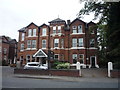
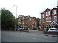
Photos of M8 6FT


Area Information
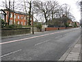
Living in M8 6FT means being part of a small, tightly knit residential cluster in England, home to 2,254 people. The area is defined by its compact size and proximity to essential services, making it practical for those prioritising convenience. With a median age of 22, the community is young, though the most common age range is 30–64, suggesting a mix of families and professionals. The postcode’s character is shaped by its housing stock—predominantly houses, which contribute to a suburban feel. While the area lacks large-scale amenities, its transport links are robust, with multiple rail and metro stations within reach. Broadband and mobile connectivity are strong, scoring 88 and 85 respectively, supporting remote work and digital lifestyles. However, residents should note the high crime risk, which is above average. For those seeking a compact, accessible location with a balance of practicality and connectivity, M8 6FT offers a distinct proposition.
- Area Type
- Postcode
- Area Size
- Not available
- Population
- 2254
- Population Density
- 9100 people/km²
The property market in M8 6FT is defined by its 50% home ownership rate, indicating a balance between owner-occupied and rental properties. The predominant accommodation type is houses, which are more common than flats or apartments. This suggests a suburban or semi-rural character, with larger homes typical of areas prioritising family living. Given the small size of the postcode, the housing stock is limited, meaning buyers may need to look beyond M8 6FT for more options. The mix of ownership and rental properties implies a stable market, though the area’s compact nature means competition for available homes could be fierce. For those seeking a house in a quiet, accessible location, M8 6FT offers a niche opportunity, but its limited scale means it is not a high-volume market.
House Prices in M8 6FT
No properties found in this postcode.
Energy Efficiency in M8 6FT
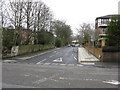
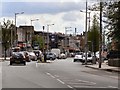
The lifestyle in M8 6FT is shaped by its practical amenities and transport links. Retail options include Tesco Cheetham, Iceland Cheetham, and Spar, providing essentials for daily living. The metro and rail stations—such as Salford Crescent and Clifton—connect residents to broader networks, facilitating access to workplaces, leisure, and services beyond the immediate area. While the data does not mention parks or leisure facilities, the presence of multiple transport hubs and shops suggests a focus on convenience over large-scale recreation. The area’s character is defined by its accessibility and the availability of everyday services, making it suitable for those prioritising practicality. However, the absence of detailed information on parks or cultural amenities means residents may need to venture further for more expansive leisure options.
Amenities
Schools
The schools near M8 6FT are all independent institutions, reflecting a focus on private education. These include Ohelei Yossef Yitzchok School, Tashbar of Manchester (with a satisfactory Ofsted rating), Etz Chaim School, and OYY Lubavitch Boys School (also with a satisfactory Ofsted rating). The presence of multiple independent schools suggests the area may attract families prioritising non-state education. However, the Ofsted ratings for two of these schools are only satisfactory, not outstanding, which may be a consideration for parents seeking top-tier education. The absence of state schools in the data means families relying on public education would need to look further afield. For those valuing private schooling, the selection here is varied, but the ratings highlight the need for due diligence when choosing a school.
| Rank | School | Type | Entry gender | Ages |
|---|
Explore more schools in this area
Go to Schools tabDemographics
The population of M8 6FT is 2,254, with a median age of 22. This contrasts with the most common age range of 30–64 years, indicating a community where younger residents coexist with middle-aged adults. Home ownership sits at 50%, suggesting a mix of owner-occupied and rental properties. The predominant accommodation type is houses, reflecting a suburban or semi-rural character. The majority of residents identify as White, though no specific data on other ethnic groups is provided. The demographic profile implies a stable, family-oriented population, with a notable absence of younger children—perhaps due to the age distribution. For those considering the area, the age mix and housing type may influence the local vibe, leaning towards a mature, established community rather than a rapidly growing one.
Household Size
Accommodation Type
Tenure
Ethnic Group
Religion
Household Composition
Age
Household Deprivation
NS-SEC
Explore more demographic insights in this area
Go to Demographics tabPlanning
Planning Constraints
- Flood RiskPremium
- Ramsar Wetland SitesPremium
- Area of Outstanding Natural BeautyPremium
- Protected Nature ReservePremium
- Protected WoodlandPremium