Area Overview for M8 5AU
Photos of M8 5AU
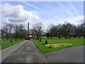
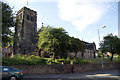
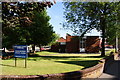
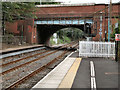
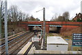
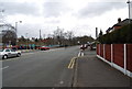
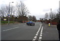
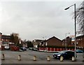


87 photos from this area
Area Information
Key information about the M8 5AU including its size, population, and administrative classification.
- Area Type
- Postcode
- Area Size
- 1.9 hectares
- Population
- 2142
- Population Density
- 7783 people/km²
House Prices in M8 5AU
42
Properties
£78,222
Average Sold Price
£10,500
Lowest Price
£232,500
Highest Price
Showing 42 properties
| Address | Type | Beds | Baths | Last Sale Price | Last Sale Date | |
|---|---|---|---|---|---|---|
| 30 Whiston Road, Manchester, M8 5AU | house | 2 | 1 | £155,090 | Jul 2025 | |
| 1 Whiston Road, Manchester, M8 5AU | Semi-detached | 3 | 1 | £140,000 | Sep 2024 | |
| 29 Whiston Road, Manchester, M8 5AU | Semi-detached | 2 | 1 | £130,000 | Oct 2022 | |
| 5 Whiston Road, Manchester, M8 5AU | house | 3 | 1 | £232,500 | Aug 2022 | |
| 14 Whiston Road, Manchester, M8 5AU | house | - | - | £134,500 | Jul 2019 | |
| 27 Whiston Road, Manchester, M8 5AU | house | 3 | - | £108,500 | Sep 2015 | |
| 26 Whiston Road, Manchester, M8 5AU | house | - | - | £75,000 | Jul 2013 | |
| 16 Whiston Road, Manchester, M8 5AU | Semi-detached | - | - | £60,000 | Jun 2013 | |
| 21 Whiston Road, Manchester, M8 5AU | house | - | - | £60,000 | Oct 2012 | |
| 19 Whiston Road, Manchester, M8 5AU | house | - | - | £90,000 | Dec 2011 |
Page 1 of 5
Energy Efficiency in M8 5AU
Amenities
Schools
| Rank | School | Type | Entry gender | Ages |
|---|
Explore more schools in this area
Go to Schools tabDemographics
Household Size
One person
most common
Accommodation Type
Houses
most common
Tenure
37
majority
Ethnic Group
asian_total
most common
Religion
N/A
most common
Household Composition
N/A
most common
Age
47
median
Adults (30-64 years)
most common
Household Deprivation
N/A
with no deprivation
NS-SEC
15
in Lower managerial occupations
Explore more demographic insights in this area
Go to Demographics tabPlanning
Planning Constraints
- Flood RiskPremium
- Ramsar Wetland SitesPremium
- Area of Outstanding Natural BeautyPremium
- Protected Nature ReservePremium
- Protected WoodlandPremium