Area Overview for M8 0GH
Photos of M8 0GH
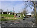

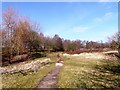


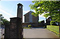


67 photos from this area
Area Information
Key information about the M8 0GH including its size, population, and administrative classification.
- Area Type
- Postcode
- Area Size
- 5.4 hectares
- Population
- 1525
- Population Density
- 6448 people/km²
House Prices in M8 0GH
30
Properties
£89,702
Average Sold Price
£16,950
Lowest Price
£225,000
Highest Price
Showing 30 properties
| Address | Type | Beds | Baths | Last Sale Price | Last Sale Date | |
|---|---|---|---|---|---|---|
| 241 Woodlands Road, Cheetham, Manchester, M8 0GH | house | - | - | £157,500 | Jan 2024 | |
| 211 Woodlands Road, Cheetham, Manchester, M8 0GH | house | - | - | £225,000 | Jun 2023 | |
| 231 Woodlands Road, Cheetham, Manchester, M8 0GH | house | - | - | £182,000 | Sep 2021 | |
| 235 Woodlands Road, Cheetham, Manchester, M8 0GH | house | - | - | £90,000 | Sep 2018 | |
| 239 Woodlands Road, Cheetham, Manchester, M8 0GH | house | - | - | £151,000 | May 2018 | |
| 233 Woodlands Road, Cheetham, Manchester, M8 0GH | house | 3 | 1 | £105,000 | Jan 2018 | |
| 203 Woodlands Road, Cheetham, Manchester, M8 0GH | house | 3 | 2 | £85,500 | Feb 2015 | |
| 245 Woodlands Road, Cheetham, Manchester, M8 0GH | Terraced | 3 | 1 | £66,500 | Jan 2014 | |
| 193 Woodlands Road, Cheetham, Manchester, M8 0GH | house | - | - | £95,000 | Nov 2013 | |
| 223 Woodlands Road, Cheetham, Manchester, M8 0GH | house | - | - | £93,500 | Apr 2011 |
Page 1 of 3
Energy Efficiency in M8 0GH
Amenities
Schools
| Rank | School | Type | Entry gender | Ages |
|---|
Explore more schools in this area
Go to Schools tabDemographics
Household Size
Family (3-5 people)
most common
Accommodation Type
Houses
most common
Tenure
54
majority
Ethnic Group
asian_total
most common
Religion
N/A
most common
Household Composition
N/A
most common
Age
47
median
Adults (30-64 years)
most common
Household Deprivation
N/A
with no deprivation
NS-SEC
16
in Lower managerial occupations
Explore more demographic insights in this area
Go to Demographics tabPlanning
Planning Constraints
- Flood RiskPremium
- Ramsar Wetland SitesPremium
- Area of Outstanding Natural BeautyPremium
- Protected Nature ReservePremium
- Protected WoodlandPremium