Area Overview for M7 4PP
Photos of M7 4PP
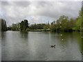
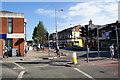
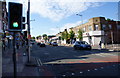
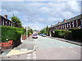
59 photos from this area
Area Information
Key information about the M7 4PP including its size, population, and administrative classification.
- Area Type
- Postcode
- Area Size
- 1.7 hectares
- Population
- 2278
- Population Density
- 10044 people/km²
House Prices in M7 4PP
54
Properties
£64,033
Average Sold Price
£16,000
Lowest Price
£125,000
Highest Price
Showing 54 properties
| Address | Type | Beds | Baths | Last Sale Price | Last Sale Date | |
|---|---|---|---|---|---|---|
| 5A St Heliers Drive, Salford, M7 4PP | Semi-detached | 1 | 1 | £125,000 | Nov 2025 | |
| 29 St Heliers Drive, Salford, M7 4PP | house | - | - | £90,000 | Aug 2017 | |
| 72 St Heliers Drive, Salford, M7 4PP | Semi-detached | 2 | 1 | £95,000 | Dec 2016 | |
| 10 St Heliers Drive, Salford, M7 4PP | Semi-detached | 2 | - | £80,000 | Dec 2014 | |
| 8 St Heliers Drive, Salford, M7 4PP | Semi-detached | 3 | - | £80,000 | Sep 2014 | |
| 25 St Heliers Drive, Salford, M7 4PP | house | 2 | - | £58,500 | Aug 2010 | |
| 5 St Heliers Drive, Salford, M7 4PP | Semi-detached | 1 | 1 | £62,500 | Jul 2010 | |
| 17 St Heliers Drive, Salford, M7 4PP | Bungalow | 2 | 1 | £86,000 | Jun 2008 | |
| 16 St Heliers Drive, Salford, M7 4PP | Semi-detached | 2 | 1 | £73,500 | Jun 2007 | |
| 78 St Heliers Drive, Salford, M7 4PP | house | - | - | £54,000 | Nov 2004 |
Page 1 of 6
Energy Efficiency in M7 4PP
Amenities
Schools
| Rank | School | Type | Entry gender | Ages |
|---|
Explore more schools in this area
Go to Schools tabDemographics
Household Size
Family (3-5 people)
most common
Accommodation Type
Houses
most common
Tenure
45
majority
Ethnic Group
White
most common
Religion
N/A
most common
Household Composition
N/A
most common
Age
22
median
Children (0-14 years)
most common
Household Deprivation
N/A
with no deprivation
NS-SEC
30
in Lower managerial occupations
Explore more demographic insights in this area
Go to Demographics tabPlanning
Planning Constraints
- Flood RiskPremium
- Ramsar Wetland SitesPremium
- Area of Outstanding Natural BeautyPremium
- Protected Nature ReservePremium
- Protected WoodlandPremium