Area Overview for M7 3QL
Photos of M7 3QL
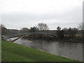
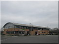
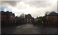
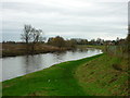
55 photos from this area
Area Information
Key information about the M7 3QL including its size, population, and administrative classification.
- Area Type
- Postcode
- Area Size
- 1.3 hectares
- Population
- 2351
- Population Density
- 2981 people/km²
House Prices in M7 3QL
8
Properties
£198,143
Average Sold Price
£49,000
Lowest Price
£270,000
Highest Price
Showing 8 properties
| Address | Type | Beds | Baths | Last Sale Price | Last Sale Date | |
|---|---|---|---|---|---|---|
| 97 Kersal Road, Salford, M7 3QL | Bungalow | 2 | 1 | £265,000 | Nov 2018 | |
| 98 Kersal Road, Salford, M7 3QL | Bungalow | 3 | 2 | £270,000 | Dec 2016 | |
| 103 Kersal Road, Salford, M7 3QL | Bungalow | 3 | 2 | £250,000 | Apr 2016 | |
| 100 Kersal Road, Salford, M7 3QL | Detached | 4 | - | £268,000 | Jul 2015 | |
| 99 Kersal Road, Salford, M7 3QL | Detached | - | - | £140,000 | Feb 2006 | |
| 95 Kersal Road, Salford, M7 3QL | Detached | 2 | 1 | £145,000 | Jan 2006 | |
| 101 Kersal Road, Salford, M7 3QL | Detached | - | - | £49,000 | Sep 1995 | |
| 93 Kersal Road, Salford, M7 3QL | Detached | - | - | - | - |
Energy Efficiency in M7 3QL
Amenities
Schools
| Rank | School | Type | Entry gender | Ages |
|---|
Explore more schools in this area
Go to Schools tabDemographics
Household Size
One person
most common
Accommodation Type
Houses
most common
Tenure
58
majority
Ethnic Group
White
most common
Religion
N/A
most common
Household Composition
N/A
most common
Age
47
median
Adults (30-64 years)
most common
Household Deprivation
N/A
with no deprivation
NS-SEC
37
in Lower managerial occupations
Explore more demographic insights in this area
Go to Demographics tabPlanning
Planning Constraints
- Flood RiskPremium
- Ramsar Wetland SitesPremium
- Area of Outstanding Natural BeautyPremium
- Protected Nature ReservePremium
- Protected WoodlandPremium