Area Overview for M7 3NA
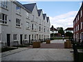
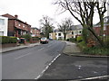
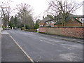
Photos of M7 3NA


Area Information
Living in M7 3NA offers a compact, residential experience in England’s northern suburbs. With a population of 2,351, this postcode area is a small cluster of homes, primarily occupied by adults aged 30–64, reflecting a mature community. The area’s character is defined by its proximity to essential services and transport links, making it practical for daily life. While not a sprawling suburb, M7 3NA is positioned near key amenities, including retail hubs, public transport, and educational institutions. The median age of 47 suggests a settled population, with a strong emphasis on home ownership—nearly 58% of residents live in their own homes. This mix of stability and accessibility makes M7 3NA a viable choice for those seeking a balanced lifestyle, though its small size means the immediate surroundings are critical for additional amenities.
- Area Type
- Postcode
- Area Size
- Not available
- Population
- 2351
- Population Density
- 2981 people/km²
The property market in M7 3NA is characterised by a 58% home ownership rate, suggesting a stable, owner-occupied demographic. The area’s primary accommodation type is houses, which implies a focus on traditional, family-friendly housing stock. Given the postcode’s small size, the housing supply is limited, and buyers should consider the immediate surrounding areas for additional options. The presence of houses over flats indicates a community prioritising space and privacy, which may appeal to those seeking a quieter, less densely populated environment. However, the small scale of M7 3NA means property availability is constrained, and potential buyers may need to look beyond the postcode for larger selections.
House Prices in M7 3NA
No properties found in this postcode.
Energy Efficiency in M7 3NA
Residents of M7 3NA benefit from a range of nearby amenities that cater to daily needs and leisure. Retail options include Lidl Sedgeley, Sainsburys Manchester, and Asda Higher, offering essential shopping within walking distance. The area’s proximity to metro stations like Bowker Vale and Heaton Park, along with rail stations such as Salford Crescent and Clifton, ensures easy access to urban centres. A single bus stop at Chorlton Street Coach Station provides additional transport flexibility. City Airport Manchester is also nearby, which is a boon for frequent travellers. While the area lacks large parks or leisure facilities, the density of retail and transport hubs suggests a practical, convenience-driven lifestyle. The mix of retail, transport, and travel options makes M7 3NA suitable for those prioritising accessibility over expansive green spaces.
Amenities
Schools
Residents of M7 3NA have access to two primary schools: St Paul’s CofE Primary School, which holds a ‘good’ Ofsted rating, and Kersal High School, also designated as a primary institution. While the data does not confirm whether Kersal High School is a secondary school, the presence of two primary schools provides convenience for families with younger children. The absence of secondary schools in the immediate area means students may need to travel to nearby postcodes for secondary education. The ‘good’ rating at St Paul’s CofE suggests a reliable educational foundation, though the overall school mix is limited to primary levels. Parents should consider the proximity of secondary schools in surrounding areas when evaluating the area’s suitability for long-term family needs.
| Rank | School | Type | Entry gender | Ages |
|---|
Explore more schools in this area
Go to Schools tabDemographics
The community in M7 3NA is predominantly composed of adults aged 30–64, with a median age of 47. This demographic suggests a population focused on established careers and family life, with fewer young dependents or retirees compared to other areas. Home ownership stands at 58%, indicating a significant proportion of residents live in their own properties, while the remaining 42% are likely to be renters or in other housing arrangements. The primary accommodation type is houses, reflecting a preference for detached or semi-detached properties over flats. The predominant ethnic group is White, though the data does not provide further breakdowns of diversity. With no specific deprivation data available, the area’s quality of life appears tied to its practical amenities and connectivity, rather than socioeconomic challenges.
Household Size
Accommodation Type
Tenure
Ethnic Group
Religion
Household Composition
Age
Household Deprivation
NS-SEC
Explore more demographic insights in this area
Go to Demographics tabPlanning
Planning Constraints
- Flood RiskPremium
- Ramsar Wetland SitesPremium
- Area of Outstanding Natural BeautyPremium
- Protected Nature ReservePremium
- Protected WoodlandPremium