Area Overview for M7 3BR
Photos of M7 3BR
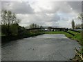


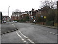
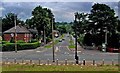
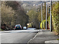

55 photos from this area
Area Information
Key information about the M7 3BR including its size, population, and administrative classification.
- Area Type
- Postcode
- Area Size
- 1.5 hectares
- Population
- 1555
- Population Density
- 5789 people/km²
House Prices in M7 3BR
20
Properties
£233,855
Average Sold Price
£102,500
Lowest Price
£370,000
Highest Price
Showing 20 properties
| Address | Type | Beds | Baths | Last Sale Price | Last Sale Date | |
|---|---|---|---|---|---|---|
| 6 Blyton Lane, Salford, M7 3BR | Detached | 5 | 3 | £370,000 | Nov 2024 | |
| 26 Blyton Lane, Salford, M7 3BR | Detached | 3 | 3 | £305,500 | Oct 2024 | |
| 22 Blyton Lane, Salford, M7 3BR | Detached | 5 | 4 | £360,000 | Apr 2022 | |
| 2 Blyton Lane, Salford, M7 3BR | house | 2 | - | £165,000 | Oct 2021 | |
| 8 Blyton Lane, Salford, M7 3BR | house | - | - | £250,000 | Aug 2020 | |
| 10 Blyton Lane, Salford, M7 3BR | Detached | 4 | 3 | £297,000 | Aug 2019 | |
| 3 Blyton Lane, Salford, M7 3BR | Detached | 5 | 3 | £260,000 | Dec 2018 | |
| 9 Blyton Lane, Salford, M7 3BR | Semi-detached | 4 | 3 | £217,500 | Nov 2018 | |
| 14 Blyton Lane, Salford, M7 3BR | Detached | 5 | 4 | £253,500 | Apr 2016 | |
| 5 Blyton Lane, Salford, M7 3BR | Flat | - | - | £117,500 | Apr 2015 |
Page 1 of 2
Energy Efficiency in M7 3BR
Amenities
Schools
| Rank | School | Type | Entry gender | Ages |
|---|
Explore more schools in this area
Go to Schools tabDemographics
Household Size
Family (3-5 people)
most common
Accommodation Type
Houses
most common
Tenure
54
majority
Ethnic Group
White
most common
Religion
N/A
most common
Household Composition
N/A
most common
Age
47
median
Adults (30-64 years)
most common
Household Deprivation
N/A
with no deprivation
NS-SEC
23
in Lower managerial occupations
Explore more demographic insights in this area
Go to Demographics tabPlanning
Planning Constraints
- Flood RiskPremium
- Ramsar Wetland SitesPremium
- Area of Outstanding Natural BeautyPremium
- Protected Nature ReservePremium
- Protected WoodlandPremium