Area Overview for M60 0AF
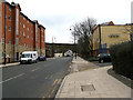
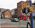
Photos of M60 0AF


Area Information
Living in M60 0AF means inhabiting a compact residential cluster in England, where the population of 1,859 residents reflects a small, tightly knit community. This postcode area is defined by its proximity to major transport routes, including the M60 motorway, and its integration with nearby urban hubs. The area’s character is shaped by its demographic profile: a median age of 22 and a strong presence of young adults aged 15–29. This suggests a dynamic, possibly student or early-career-oriented population. Daily life here is influenced by the surrounding infrastructure, with easy access to rail and metro stations, as well as retail and dining options within walking distance. The area’s small size means residents are likely to know their neighbours, though the low home ownership rate of 14% indicates a rental-dominated market. For those considering living in M60 0AF, the blend of urban connectivity and residential scale offers a distinct lifestyle compared to larger cities or rural areas.
- Area Type
- Postcode
- Area Size
- Not available
- Population
- 1859
- Population Density
- 7172 people/km²
The property market in M60 0AF is characterised by a low home ownership rate of 14%, indicating that the majority of residents rent their homes. The accommodation type is predominantly flats, which suggests a focus on smaller, urban living spaces. This rental-driven market is typical of areas with strong transport links and proximity to educational institutions, as seen in the nearby schools. For buyers, the small scale of the area and its immediate surroundings means that property options are limited, with a concentration on flats rather than larger family homes. The low home ownership rate also implies competition for available properties, particularly among young professionals and students seeking affordable housing. Those considering purchasing in M60 0AF should factor in the area’s rental market dynamics and the potential for limited long-term investment in property.
House Prices in M60 0AF
No properties found in this postcode.
Energy Efficiency in M60 0AF
The lifestyle in M60 0AF is shaped by its proximity to a variety of amenities. Within walking distance are five retail outlets, including Co-op Balloon, Spar, and Co-op Manchester, offering everyday shopping needs. The area’s transport links provide easy access to leisure and dining options in nearby urban centres. Five metro stations and multiple rail stops ensure swift travel to cultural or recreational hubs. The presence of a single bus station, Chorlton Street Coach Station, adds flexibility for local travel. While the area’s small size limits the diversity of venues, the concentration of retail and transport options supports a convenient, urbanised lifestyle. Residents can enjoy a mix of practical amenities and connectivity to larger city facilities, making M60 0AF suitable for those prioritising accessibility over expansive leisure choices.
Amenities
Schools
The schools nearest to M60 0AF include The Cooperative College, which is classified as an 'other' type, and Digital Advantage, a special school. These institutions cater to a range of educational needs, though the absence of traditional primary or secondary schools suggests that families may need to look beyond the immediate area for comprehensive education. The Cooperative College’s designation as 'other' could indicate a vocational or specialist focus, while Digital Advantage’s specialisation implies support for students with specific learning requirements. For families, this mix of school types means that parents may need to consider commuting or supplementary education options. The proximity of these schools to M60 0AF reflects the area’s alignment with urban educational infrastructure, though the lack of a broader school network may limit choices for those prioritising local schooling.
| Rank | School | Type | Entry gender | Ages |
|---|
Explore more schools in this area
Go to Schools tabDemographics
The community in M60 0AF is overwhelmingly young, with a median age of 22 and 14% of residents owning their homes. The most common age range, 15–29 years, suggests a population skewed towards students, graduates, or early-career professionals. The predominant ethnic group is White, and the accommodation type is predominantly flats, reflecting a rental-heavy market. This demographic profile indicates a transient or student-driven population, with limited long-term household stability. The low home ownership rate (14%) reinforces the area’s role as a rental hub rather than a place for family homes. For quality of life, this dynamic may mean a more fluid community with shifting social networks, though it also aligns with proximity to educational institutions and transport links. The absence of specific deprivation data means the area’s economic challenges cannot be fully assessed, but the youth-centric makeup implies a focus on affordability over established family-oriented amenities.
Household Size
Accommodation Type
Tenure
Ethnic Group
Religion
Household Composition
Age
Household Deprivation
NS-SEC
Explore more demographic insights in this area
Go to Demographics tabPlanning
Planning Constraints
- Flood RiskPremium
- Ramsar Wetland SitesPremium
- Area of Outstanding Natural BeautyPremium
- Protected Nature ReservePremium
- Protected WoodlandPremium