Area Overview for M6 8RD
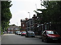
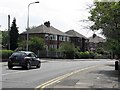
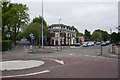
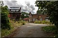
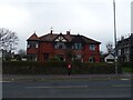
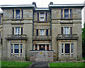
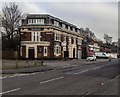
Photos of M6 8RD


Area Information
M6 8RD is a compact residential postcode in England, covering just 5.9 hectares and home to 1,575 residents. Its high population density of 26,650 people per square kilometre reflects a tightly knit community, where proximity to amenities and transport is a defining feature. The area’s small size means it is likely centred around a core of homes, possibly with limited green space, but its strategic location offers access to nearby services. Daily life here is shaped by the mix of local shops, schools, and transport links, which cater to a predominantly adult population. With a median age of 47, the community is mature, with many residents in the 30–64 age range. This suggests a balance between established families and older professionals, creating a dynamic but stable environment. The area’s proximity to Salford City College and other educational institutions hints at a focus on learning and career development, while its digital connectivity scores indicate modern infrastructure. For buyers, M6 8RD offers a blend of practicality and accessibility, though its small footprint means every decision about living here is closely tied to its immediate surroundings.
- Area Type
- Postcode
- Area Size
- 5.9 hectares
- Population
- 1575
- Population Density
- 5812 people/km²
M6 8RD is a predominantly owner-occupied area, with 61% of residents living in homes they own. The accommodation type is largely houses, which may suggest a focus on family homes or larger properties. Given the area’s small size and high population density, the housing stock is likely limited to a few clusters of homes, possibly with limited scope for new development. This makes the property market relatively niche, with buyers needing to consider the proximity to key amenities and transport links. The high home ownership rate indicates a stable market, but the compact nature of the area means competition for properties could be fierce. For those seeking a home, the emphasis on houses may appeal to families, though the small footprint of the postcode means buyers must weigh the benefits of local convenience against the constraints of limited space. The area’s immediate surroundings may offer more options, but M6 8RD itself is likely to be a tightly held community.
House Prices in M6 8RD
No properties found in this postcode.
Energy Efficiency in M6 8RD
M6 8RD offers a range of amenities within easy reach, including five retail outlets such as Tesco Salford, Aldi Irlam, and Lidl Pendleton. These shops provide everyday essentials, supporting a convenient lifestyle. The area’s proximity to metro stations like Weaste and Langworthy, along with rail services at Salford Crescent and Eccles, ensures easy access to wider urban areas. A bus stop at Chorlton Street Coach Station adds to the transport options, while the nearby City Airport Manchester offers regional travel connections. The mix of retail, transport, and educational facilities creates a self-contained environment, reducing the need for long commutes. For residents, this blend of services fosters a practical, accessible daily life, with opportunities for shopping, travel, and education all within a short distance.
Amenities
Schools
Residents of M6 8RD have access to a range of educational institutions, including Summerhill School, a special school; Salford City College, a sixth-form college; Salford Education Inclusion Services at Halton House, which provides other specialist support; and Buile Hill Academy, an academy. This mix of school types offers flexibility for families, from early years support through to further education. The presence of a special school and inclusion services suggests the area caters to diverse educational needs, while the sixth-form college provides pathways for post-16 learners. For parents, the availability of multiple school types ensures options for different stages of a child’s education, though the specific quality of these institutions is not detailed in the data. The proximity of these schools to M6 8RD underscores the area’s suitability for families prioritising access to education.
| Rank | School | Type | Entry gender | Ages |
|---|
Explore more schools in this area
Go to Schools tabDemographics
The population of M6 8RD is predominantly adults aged 30–64, with a median age of 47. This suggests a community of established professionals and families, rather than students or retirees. Home ownership is strong, with 61% of residents owning their homes, indicating a stable housing market. The accommodation type is primarily houses, which may reflect a preference for family-friendly living spaces. The predominant ethnic group is White, though the data does not provide further breakdowns on diversity or deprivation levels. The high population density of 26,650 people per square kilometre means living spaces are closely packed, which could influence the character of the area, with shared amenities and a sense of communal life. For buyers, this demographic profile implies a mature, settled community with a focus on long-term residency rather than transient populations. The lack of specific data on deprivation or diversity means the area’s social dynamics remain somewhat opaque, but the figures provided paint a picture of stability and continuity.
Household Size
Accommodation Type
Tenure
Ethnic Group
Religion
Household Composition
Age
Household Deprivation
NS-SEC
Explore more demographic insights in this area
Go to Demographics tabPlanning
Planning Constraints
- Flood RiskPremium
- Ramsar Wetland SitesPremium
- Area of Outstanding Natural BeautyPremium
- Protected Nature ReservePremium
- Protected WoodlandPremium