Area Overview for M6 7GP
Photos of M6 7GP
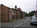
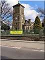
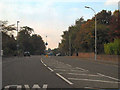
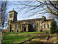
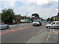
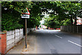


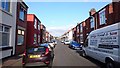
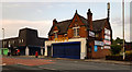
32 photos from this area
Area Information
Key information about the M6 7GP including its size, population, and administrative classification.
- Area Type
- Postcode
- Area Size
- 7071 m²
- Population
- 1595
- Population Density
- 9797 people/km²
House Prices in M6 7GP
21
Properties
£228,722
Average Sold Price
£53,500
Lowest Price
£415,500
Highest Price
Showing 21 properties
| Address | Type | Beds | Baths | Last Sale Price | Last Sale Date | |
|---|---|---|---|---|---|---|
| 89 Claremont Road, Salford, M6 7GP | Semi-detached | 6 | 2 | £415,500 | Dec 2022 | |
| 83 Claremont Road, Salford, M6 7GP | Retail | 5 | 2 | £355,000 | Jul 2022 | |
| 71 Claremont Road, Salford, M6 7GP | Retail | 5 | 2 | £392,500 | Jun 2022 | |
| 80 Claremont Road, Salford, M6 7GP | Semi-detached | 3 | 2 | £255,000 | Nov 2020 | |
| 78 Claremont Road, Salford, M6 7GP | Semi-detached | 4 | 1 | £278,000 | Sep 2019 | |
| 79 Claremont Road, Salford, M6 7GP | Semi-detached | 5 | 2 | £333,000 | Apr 2019 | |
| 72 Claremont Road, Salford, M6 7GP | Semi-detached | 4 | - | £260,000 | Jul 2016 | |
| 87 Claremont Road, Salford, M6 7GP | Semi-detached | 5 | 3 | £310,000 | Jul 2016 | |
| 81 Claremont Road, Salford, M6 7GP | Semi-detached | 5 | - | £250,000 | May 2016 | |
| 84 Claremont Road, Salford, M6 7GP | Detached | 4 | 2 | £210,000 | Nov 2015 |
Page 1 of 3
Energy Efficiency in M6 7GP
Amenities
Schools
| Rank | School | Type | Entry gender | Ages |
|---|
Explore more schools in this area
Go to Schools tabDemographics
Household Size
Family (3-5 people)
most common
Accommodation Type
Houses
most common
Tenure
56
majority
Ethnic Group
White
most common
Religion
N/A
most common
Household Composition
N/A
most common
Age
47
median
Adults (30-64 years)
most common
Household Deprivation
N/A
with no deprivation
NS-SEC
36
in Lower managerial occupations
Explore more demographic insights in this area
Go to Demographics tabPlanning
Planning Constraints
- Flood RiskPremium
- Ramsar Wetland SitesPremium
- Area of Outstanding Natural BeautyPremium
- Protected Nature ReservePremium
- Protected WoodlandPremium