Area Overview for M6 6NG
Photos of M6 6NG
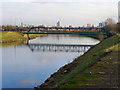
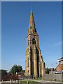
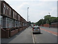
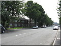
50 photos from this area
Area Information
Key information about the M6 6NG including its size, population, and administrative classification.
- Area Type
- Postcode
- Area Size
- 2.6 hectares
- Population
- 1043
- Population Density
- 1596 people/km²
House Prices in M6 6NG
58
Properties
£263,667
Average Sold Price
£209,950
Lowest Price
£334,950
Highest Price
Showing 58 properties
| Address | Type | Beds | Baths | Last Sale Price | Last Sale Date | |
|---|---|---|---|---|---|---|
| 2 Ribot Walk, Salford, M6 6NG | Retail | 3 | 3 | £285,000 | Nov 2025 | |
| 30 Ribot Walk, Salford, M6 6NG | Terraced | 2 | 1 | £285,000 | Aug 2025 | |
| 62 Ribot Walk, Salford, M6 6NG | Terraced | 3 | 2 | £313,000 | Mar 2025 | |
| 66 Ribot Walk, Salford, M6 6NG | Semi-detached | 2 | 1 | £282,000 | Dec 2024 | |
| 16 Ribot Walk, Salford, M6 6NG | Semi-detached | 3 | 2 | £259,950 | Aug 2022 | |
| 14 Ribot Walk, Salford, M6 6NG | Terraced | 3 | 2 | £254,950 | Aug 2022 | |
| 112 Ribot Walk, Salford, M6 6NG | house | - | - | £333,950 | Jul 2022 | |
| 114 Ribot Walk, Salford, M6 6NG | Semi-detached | 4 | 2 | £334,950 | Jul 2022 | |
| 104 Ribot Walk, Salford, M6 6NG | house | - | - | £259,950 | Jul 2022 | |
| 108 Ribot Walk, Salford, M6 6NG | house | - | - | £254,950 | Jun 2022 |
Page 1 of 6
Energy Efficiency in M6 6NG
Amenities
Schools
| Rank | School | Type | Entry gender | Ages |
|---|
Explore more schools in this area
Go to Schools tabDemographics
Household Size
Family (3-5 people)
most common
Accommodation Type
Houses
most common
Tenure
35
majority
Ethnic Group
White
most common
Religion
N/A
most common
Household Composition
N/A
most common
Age
22
median
Young Adults (15-29 years)
most common
Household Deprivation
N/A
with no deprivation
NS-SEC
20
in Lower managerial occupations
Explore more demographic insights in this area
Go to Demographics tabPlanning
Planning Constraints
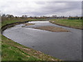
- Flood RiskPremium
- Ramsar Wetland SitesPremium
- Area of Outstanding Natural BeautyPremium
- Protected Nature ReservePremium
- Protected WoodlandPremium