Area Overview for M6 5NT
Photos of M6 5NT
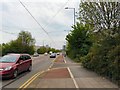
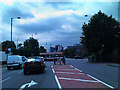


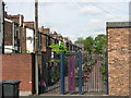
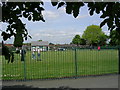
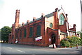
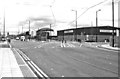

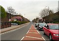
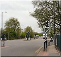

62 photos from this area
Area Information
Key information about the M6 5NT including its size, population, and administrative classification.
- Area Type
- Postcode
- Area Size
- 1465 m²
- Population
- 1697
- Population Density
- 11451 people/km²
House Prices in M6 5NT
9
Properties
£137,900
Average Sold Price
£11,000
Lowest Price
£225,000
Highest Price
Showing 9 properties
| Address | Type | Beds | Baths | Last Sale Price | Last Sale Date | |
|---|---|---|---|---|---|---|
| 42 Seedley Park Road, Salford, M6 5NT | Terraced | 3 | 1 | £225,000 | Apr 2024 | |
| 40 Seedley Park Road, Salford, M6 5NT | Terraced | 4 | 1 | £210,000 | Dec 2022 | |
| 34 Seedley Park Road, Salford, M6 5NT | house | - | - | £195,000 | Feb 2022 | |
| 36 Seedley Park Road, Salford, M6 5NT | Terraced | 3 | 1 | £110,000 | Aug 2021 | |
| 30 Seedley Park Road, Salford, M6 5NT | Terraced | 2 | 1 | £126,800 | May 2020 | |
| 24 Seedley Park Road, Salford, M6 5NT | Terraced | 3 | - | £87,500 | Jul 2006 | |
| 38 Seedley Park Road, Salford, M6 5NT | house | - | - | £11,000 | Feb 1999 | |
| 26 Seedley Park Road, Salford, M6 5NT | Terraced | - | - | - | - | |
| 28 Seedley Park Road, Salford, M6 5NT | Bungalow | - | - | - | - |
Energy Efficiency in M6 5NT
Amenities
Schools
| Rank | School | Type | Entry gender | Ages |
|---|
Explore more schools in this area
Go to Schools tabDemographics
Household Size
Family (3-5 people)
most common
Accommodation Type
Houses
most common
Tenure
38
majority
Ethnic Group
White
most common
Religion
N/A
most common
Household Composition
N/A
most common
Age
47
median
Adults (30-64 years)
most common
Household Deprivation
N/A
with no deprivation
NS-SEC
20
in Lower managerial occupations
Explore more demographic insights in this area
Go to Demographics tabPlanning
Planning Constraints
- Flood RiskPremium
- Ramsar Wetland SitesPremium
- Area of Outstanding Natural BeautyPremium
- Protected Nature ReservePremium
- Protected WoodlandPremium