Area Overview for M5 5JD
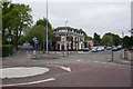
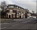
Photos of M5 5JD


Area Information
Living in M5 5JD means inhabiting a densely populated, compact residential cluster in England. The area covers just 3,283 square metres, housing 1,911 people at a density of 582,039 per square kilometre. This small postcode is defined by its proximity to urban infrastructure, with five metro stations—including Weaste, Langworthy, and Ladywell—within practical reach. Daily life here is shaped by its connectivity: residents can access five rail stations, including Eccles and Manchester United FC Railway Station, and a nearby bus stop at Chorlton Street Coach Station. The area’s broadband score of 99 ensures near-flawless internet access, while mobile coverage of 85 is reliable for most needs. However, the high population density and limited space mean living here requires adaptation to a tightly packed environment. Despite this, the area’s proximity to retail hubs like Lidl Pendleton, M&S WHS, and Tesco Salford offers convenience for everyday errands. For buyers, M5 5JD is a compact, well-connected postcode, but its small size and high density demand careful consideration of lifestyle preferences.
- Area Type
- Postcode
- Area Size
- 3283 m²
- Population
- 1911
- Population Density
- 10742 people/km²
The property market in M5 5JD is characterised by a low home ownership rate of 39%, suggesting that the majority of properties are rented rather than owner-occupied. Despite this, the accommodation type is predominantly houses, which is unusual for a high-density area. This mix of rental properties and single-family homes indicates a niche market where buyers may find limited options. The small area size of 3,283 square metres, combined with the high population density, means that properties are likely to be compact, with little scope for expansion. For buyers, this suggests a focus on existing homes rather than new developments. The area’s proximity to transport links and retail amenities may appeal to those prioritising convenience over space. However, the limited land area and high density could make this a challenging market for those seeking larger properties or long-term investment.
House Prices in M5 5JD
Showing 10 properties
| Address | Type | Beds | Baths | Last Sale Price | Last Sale Date | |
|---|---|---|---|---|---|---|
| 2 Whitegate Drive, Salford, M5 5JD | Semi-detached | 3 | 1 | £230,000 | May 2023 | |
| 4 Whitegate Drive, Salford, M5 5JD | house | - | - | £211,000 | Jul 2021 | |
| 5 Whitegate Drive, Salford, M5 5JD | Semi-detached | 3 | 1 | £240,000 | Mar 2021 | |
| 3 Whitegate Drive, Salford, M5 5JD | Semi-detached | 3 | 1 | £226,500 | Sep 2019 | |
| 8 Whitegate Drive, Salford, M5 5JD | house | - | - | £168,000 | Aug 2019 | |
| 1 Whitegate Drive, Salford, M5 5JD | Semi-detached | 3 | 1 | £185,000 | Mar 2019 | |
| 7 Whitegate Drive, Salford, M5 5JD | Semi-detached | 3 | - | £132,000 | Jan 2007 | |
| 10 Whitegate Drive, Salford, M5 5JD | Semi-detached | - | - | - | - | |
| 6 Whitegate Drive, Salford, M5 5JD | Semi-detached | - | - | - | - | |
| 9 Whitegate Drive, Salford, M5 5JD | Semi-detached | - | - | - | - |
Energy Efficiency in M5 5JD
Life in M5 5JD is shaped by its proximity to a range of practical amenities. Retail options include Lidl Pendleton, M&S WHS, and Tesco Salford, providing access to groceries, clothing, and daily essentials. The area’s metro stations—Weaste, Langworthy, and Ladywell—offer easy access to public transport, while rail links like Eccles and Manchester United FC Railway Station connect residents to broader regional networks. A single bus stop at Chorlton Street Coach Station adds to the transport options. The nearby City Airport Manchester is within reach for those requiring air travel. These amenities contribute to a lifestyle that prioritises convenience and connectivity. However, the high density and compact size mean that leisure and green spaces are limited. Residents rely heavily on public transport and nearby retail hubs, making the area ideal for those who value accessibility over expansive private outdoor areas.
Amenities
Schools
| Rank | School | Type | Entry gender | Ages |
|---|
Explore more schools in this area
Go to Schools tabDemographics
The community in M5 5JD is predominantly middle-aged, with a median age of 47 and the most common age range being adults aged 30–64. Home ownership here is relatively low at 39%, suggesting a significant proportion of residents rent their homes. The accommodation type is primarily houses, which is notable given the area’s high population density. The predominant ethnic group is White, reflecting a homogenous demographic profile. The area’s population density of 582,039 people per square kilometre is exceptionally high, which may impact the sense of space and community dynamics. This density, combined with the age profile, indicates a mature, stable population with established routines. However, the low home ownership rate could imply a transient or rental-driven community. Residents may face challenges related to overcrowding or limited private outdoor space, though the area’s infrastructure and amenities aim to offset these constraints.
Household Size
Accommodation Type
Tenure
Ethnic Group
Religion
Household Composition
Age
Household Deprivation
NS-SEC
Explore more demographic insights in this area
Go to Demographics tabPlanning
Planning Constraints
- Flood RiskPremium
- Ramsar Wetland SitesPremium
- Area of Outstanding Natural BeautyPremium
- Protected Nature ReservePremium
- Protected WoodlandPremium