Area Overview for M5 5GB
Photos of M5 5GB


Area Information
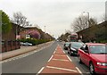
Living in M5 5GB means inhabiting a compact, densely populated residential cluster in England. The area spans 6,296 square metres, housing 1,661 people, resulting in a population density of 263,823 people per square kilometre. This high density suggests a tightly knit community, though the small size means the area is not expansive. The median age of 47 indicates a mature demographic, with the majority of residents aged between 30 and 64. Daily life here is likely shaped by proximity to amenities, including five metro stations, multiple retail outlets, and rail links. The area’s small footprint means it is not a sprawling suburb but a focused cluster of homes, possibly with a strong sense of local identity. Residents benefit from nearby schools, including an independent institution and a primary school, as well as transport options connecting to Manchester and beyond. The compact nature of M5 5GB may appeal to those seeking convenience over space, though the high population density could influence the character of the neighbourhood.
- Area Type
- Postcode
- Area Size
- 6296 m²
- Population
- 1661
- Population Density
- 2590 people/km²
The property market in M5 5GB is characterised by a low home ownership rate of 31%, suggesting that the area is not primarily owner-occupied but rather a rental market. The accommodation type is predominantly houses, which may indicate a mix of semi-detached or terraced properties typical of smaller residential clusters. Given the high population density and small area size, the housing stock is likely limited, with limited scope for new developments. For buyers, this means the market is constrained by space, and properties may be in high demand due to the area’s proximity to amenities like schools and transport links. However, the low ownership rate could also mean competition among renters, potentially affecting property values and availability. Buyers should consider the compact nature of the area and its reliance on nearby services for a complete lifestyle.
House Prices in M5 5GB
Showing 29 properties
| Address | Type | Beds | Baths | Last Sale Price | Last Sale Date | |
|---|---|---|---|---|---|---|
| 154 Stowell Street, Salford, M5 5GB | house | - | - | £75,000 | Feb 2022 | |
| 151 Stowell Street, Salford, M5 5GB | Flat | - | - | £76,000 | Feb 2021 | |
| 149 Stowell Street, Salford, M5 5GB | Flat | - | - | - | - | |
| 131 Stowell Street, Salford, M5 5GB | house | - | - | - | - | |
| 123 Stowell Street, Salford, M5 5GB | house | - | - | - | - | |
| 125 Stowell Street, Salford, M5 5GB | house | - | - | - | - | |
| 127 Stowell Street, Salford, M5 5GB | house | - | - | - | - | |
| 146 Stowell Street, Salford, M5 5GB | house | - | - | - | - | |
| 153 Stowell Street, Salford, M5 5GB | Flat | - | - | - | - | |
| 143 Stowell Street, Salford, M5 5GB | Flat | - | - | - | - |
Energy Efficiency in M5 5GB
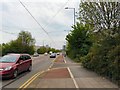
Residents of M5 5GB enjoy access to a range of amenities within practical reach. The area includes five metro stations—Langworthy, Weaste, and Broadway—facilitating easy travel to nearby districts. Retail options are plentiful, with outlets such as Co-op Salford, Lidl Pendleton, and Sainsburys Salford offering everyday shopping needs. Rail services at Salford Crescent, Eccles, and Manchester United FC stations connect to broader transport networks, while Chorlton Street Coach Station provides additional local routes. The proximity to City Airport Manchester adds convenience for frequent travellers. These amenities contribute to a practical, accessible lifestyle, with opportunities for shopping, commuting, and travel without needing to venture far. The mix of retail, transport, and travel hubs suggests a functional, well-connected community, though the small area size may mean amenities are closely clustered rather than spread out.
Amenities
Schools
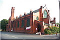
Residents of M5 5GB have access to two schools within practical reach. King of Kings is an independent school with an Ofsted rating of satisfactory, offering a private education option for families. All Souls RC Primary School is a state-funded primary institution, providing a Catholic education. The presence of both independent and state schools offers families flexibility in choosing educational paths. The independent school may appeal to those seeking alternative curricula or smaller class sizes, while the primary school provides a local, community-focused option. The combination of school types suggests a diverse educational landscape, though the data does not indicate performance metrics beyond Ofsted’s satisfactory rating for King of Kings. Families should visit both institutions to assess which aligns best with their needs.
| Rank | School | Type | Entry gender | Ages |
|---|
Explore more schools in this area
Go to Schools tabDemographics
The community in M5 5GB is predominantly composed of adults aged 30 to 64, with a median age of 47. This suggests a mature population, likely with established careers and families. Home ownership rates are relatively low at 31%, indicating that a significant portion of residents rent their homes. The accommodation type is primarily houses, which, combined with the low ownership rate, may reflect a mix of owner-occupied properties and rental units. The predominant ethnic group is White, though the data does not provide further breakdowns of diversity. The high population density—263,823 people per square kilometre—means the area is intensely populated, which could influence local services and infrastructure. For residents, this density may translate to a lively, close-knit environment but could also mean limited space for expansion or new developments.
Household Size
Accommodation Type
Tenure
Ethnic Group
Religion
Household Composition
Age
Household Deprivation
NS-SEC
Explore more demographic insights in this area
Go to Demographics tabPlanning
Planning Constraints
- Flood RiskPremium
- Ramsar Wetland SitesPremium
- Area of Outstanding Natural BeautyPremium
- Protected Nature ReservePremium
- Protected WoodlandPremium