Area Overview for M5 5AD
Photos of M5 5AD


Area Information
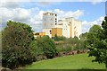
Living in M5 5AD means inhabiting a compact, densely populated residential cluster in England. The area covers just 1.6 hectares, yet it accommodates 2,038 residents, resulting in a population density of 124,262 people per square kilometre. This high density suggests a tightly knit community, though the small size means the area is best suited for those prioritising proximity to urban amenities over expansive living space. The demographics indicate a mature population, with a median age of 47 and most residents aged between 30 and 64. Daily life here is likely shaped by the proximity to transport hubs and retail outlets, with residents relying heavily on public services and nearby infrastructure. The area’s compact nature means it is ideal for commuters or those seeking convenience over privacy, though the limited space may impact the availability of larger homes. M5 5AD is not a place for sprawling estates, but rather a focused, utilitarian postcode where proximity to services is a defining feature.
- Area Type
- Postcode
- Area Size
- 1.6 hectares
- Population
- 2038
- Population Density
- 2900 people/km²
The property market in M5 5AD is defined by its high density and limited space. With 29% of residents owning their homes, the area is primarily a rental market, suggesting a reliance on private landlords or housing associations. The accommodation type is exclusively flats, which aligns with the small area size and high population density. This means buyers seeking larger properties or detached homes are unlikely to find them here. The compact nature of the area may also limit scope for redevelopment, making it a niche market for those prioritising location over property size. For buyers, the challenge lies in the scarcity of available homes, with competition likely to be fierce. The proximity to transport links and amenities may offset the lack of space, but the small area size means the immediate surroundings are critical for finding additional options.
House Prices in M5 5AD
Showing 48 properties
Energy Efficiency in M5 5AD
The lifestyle in M5 5AD is shaped by its proximity to a variety of amenities. Residents have access to five retail outlets, including Lidl West, Iceland Eccles, and Sainsburys Eccles, ensuring everyday shopping needs are met. The area’s metro and rail links provide easy access to larger urban centres, while the nearby City Airport Manchester caters to frequent flyers. The presence of multiple transport hubs, including Eccles Railway Station and Patricroft Railway Station, supports a dynamic, mobile lifestyle. Though the data does not mention parks or leisure facilities, the density of retail and transport options suggests a focus on convenience over expansive recreational spaces. For those prioritising accessibility and urban connectivity, M5 5AD offers a compact, well-serviced environment.
Amenities
Schools
Residents of M5 5AD have access to a range of educational institutions, though the data does not include Ofsted ratings. Nearby nurseries include Stott Lane Nursery School and Ladywell Community Nursery Centre, both offering early-years education. Additional facilities such as The Canterbury Centre and Arbour Academy are also listed, though their specific educational focus is not detailed. The presence of multiple nurseries suggests the area caters to young families, though the absence of primary or secondary schools in the data means families may need to travel beyond M5 5AD for comprehensive schooling. The mix of nursery and other educational institutions indicates a partial focus on early education, but parents should consider the broader local school network when assessing suitability for their children’s needs.
| Rank | School | Type | Entry gender | Ages |
|---|
Explore more schools in this area
Go to Schools tabDemographics
The community in M5 5AD is predominantly composed of adults aged 30 to 64, with a median age of 47. This suggests a population that is largely in or near retirement age, with fewer younger families or students. Home ownership is low, at just 29%, indicating that most residents are likely to be renters. The accommodation type is predominantly flats, reflecting the area’s high density and compact footprint. The predominant ethnic group is White, though no specific data on diversity or deprivation is provided. The age profile implies a community with established careers and possibly limited demand for schools catering to younger children. The high proportion of renters and the focus on flats suggest a transient or economically driven population, with fewer long-term residents. This demographic profile shapes the area’s character, prioritising affordability and accessibility over family-oriented amenities.
Household Size
Accommodation Type
Tenure
Ethnic Group
Religion
Household Composition
Age
Household Deprivation
NS-SEC
Explore more demographic insights in this area
Go to Demographics tabPlanning
Planning Constraints
- Flood RiskPremium
- Ramsar Wetland SitesPremium
- Area of Outstanding Natural BeautyPremium
- Protected Nature ReservePremium
- Protected WoodlandPremium