Area Overview for M5 4YB
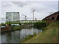
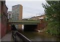
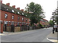
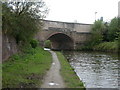
Photos of M5 4YB


Area Information
Living in M5 4YB means being part of a small, tightly knit residential cluster in England, home to 2,138 residents. This postcode area is compact, with a population that skews young, reflecting the median age of 22. Daily life here is shaped by proximity to local amenities and transport links. The area is not defined by sprawling estates but by a mix of housing types, though the data shows a predominance of houses over flats. Residents benefit from nearby schools, retail hubs, and public transport options, making it a practical choice for those seeking convenience without the bustle of larger cities. The community is young, with most residents aged 15–29, suggesting a dynamic, possibly student or early-career demographic. While the area lacks natural constraints like protected woodlands or AONB designations, it sits near urban infrastructure, including metro stations and railway links. For buyers, M5 4YB offers a snapshot of suburban living with direct access to city amenities, though the small population means it is not a high-density area.
- Area Type
- Postcode
- Area Size
- Not available
- Population
- 2138
- Population Density
- 8329 people/km²
The property market in M5 4YB is characterised by a low home ownership rate of 16%, which points to a rental-dominated landscape. The accommodation type is predominantly houses, which is atypical for areas with high student populations or young professionals. This suggests a mix of owner-occupied homes and rental properties, though the small population size means the market is limited in scale. For buyers, the area’s housing stock is likely to consist of smaller, family-friendly homes rather than high-density developments. The lack of flats or apartments may appeal to those prioritising space over urban convenience. However, the low home ownership percentage could indicate limited long-term investment potential, with properties more likely to be held by landlords than owner-occupiers. Buyers should consider the area’s small size and proximity to transport links, which may influence property values and desirability for commuters.
House Prices in M5 4YB
Showing 68 properties
Energy Efficiency in M5 4YB
The lifestyle in M5 4YB is shaped by its proximity to retail, transport, and leisure hubs. Residents have access to five notable retail outlets, including Co-op Salford and Waitrose Little, offering everyday shopping needs. The area’s transport network includes metro stations like Cornbrook and Pomona, railway stations such as Salford Central, and a bus coach station at Chorlton Street, facilitating easy travel to nearby cities and attractions. The nearby City Airport Manchester adds to the area’s connectivity. Leisure options are limited to the listed amenities, but the presence of multiple transport links suggests opportunities for cultural or recreational activities beyond the immediate postcode. The mix of retail and transport infrastructure supports a practical, commuter-friendly lifestyle, though the small population size means social hubs are likely to be modest in scale.
Amenities
Schools
Residents of M5 4YB have access to two schools within practical reach: Ordsall Community Nursery Centre, a nursery, and St Clement’s Egerton CofE Primary School, a primary school. These institutions cater to early years education and primary-level needs, though no secondary schools are listed in the data. The absence of secondary education options may require families to look beyond the immediate area for comprehensive schooling. The mix of nursery and primary schools suggests the community is suitable for young families, but the lack of higher education facilities could be a limitation. Parents should verify the catchment areas and transportation links to nearby secondary schools, as the data does not specify their locations.
| Rank | School | Type | Entry gender | Ages |
|---|
Explore more schools in this area
Go to Schools tabDemographics
The population of M5 4YB is overwhelmingly young, with a median age of 22 and the majority of residents aged 15–29. This suggests a community shaped by students, young professionals, or those starting families. Home ownership is low at 16%, indicating a rental market dominates. The accommodation type is primarily houses, which is unusual for an area with such a young demographic, as flats are more common in similar postcode clusters. The predominant ethnic group is White, though no data on diversity beyond this is provided. The lack of specific deprivation data means it is unclear how this affects quality of life, but the low home ownership rate could imply financial pressures or a transient population. The area’s youthfulness and housing stock suggest it may cater to those seeking affordability over long-term investment, though the small population size limits the scope for community services or social infrastructure.
Household Size
Accommodation Type
Tenure
Ethnic Group
Religion
Household Composition
Age
Household Deprivation
NS-SEC
Explore more demographic insights in this area
Go to Demographics tabPlanning
Planning Constraints
- Flood RiskPremium
- Ramsar Wetland SitesPremium
- Area of Outstanding Natural BeautyPremium
- Protected Nature ReservePremium
- Protected WoodlandPremium