Area Overview for M5 4UD
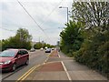
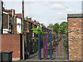
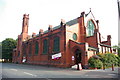
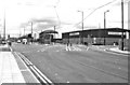
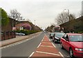
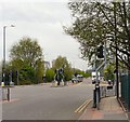
Photos of M5 4UD


Area Information
Living in M5 4UD means being part of a densely populated, compact residential cluster in England. The area covers 2979 square metres and is home to 2271 residents, making it one of the most densely populated postcode areas in the country. Despite its small size, it offers proximity to key urban hubs like Manchester and Salford, with easy access to transport networks and amenities. Daily life here is shaped by its proximity to retail, leisure, and public transport, though the area’s high population density may influence the pace of living. Residents benefit from nearby schools, including a primary school and an academy with a good Ofsted rating, and a range of shops and services within walking distance. However, the area’s compact nature means it is best suited for those prioritising convenience over expansive space. The surrounding environment is characterised by a mix of urban and semi-urban features, with no major natural reserves or protected areas nearby. For those seeking a dynamic, compact living environment with strong connectivity, M5 4UD offers a distinct blend of accessibility and proximity to city life.
- Area Type
- Postcode
- Area Size
- 2979 m²
- Population
- 2271
- Population Density
- 3638 people/km²
The property market in M5 4UD is characterised by a low home ownership rate of 19%, suggesting that the majority of residents rent their homes. The primary accommodation type is houses, which is notable given the area’s small size and high population density. This combination implies a limited housing stock with a focus on single-family units, possibly catering to specific buyer preferences. The small area’s constraints mean that property availability is likely limited, and competition for homes may be high. For buyers, this suggests a market where investment opportunities may be scarce, but existing homeowners could benefit from stability in a rental-focused environment. The predominance of houses may appeal to those seeking larger living spaces, though the compact nature of the area may limit outdoor space. Proximity to transport and amenities could enhance property value, but buyers should consider the area’s density and the challenges of a low-ownership market.
House Prices in M5 4UD
No properties found in this postcode.
Energy Efficiency in M5 4UD
Residents of M5 4UD enjoy a range of amenities within easy reach, enhancing daily life. Retail options include supermarkets such as Co-op Salford, Sainsburys Salford, and Lidl Pendleton, providing access to groceries and everyday essentials. The area’s metro stations, like Langworthy and Broadway, connect to broader urban centres, offering shopping, dining, and entertainment opportunities. Nearby leisure and cultural venues, including Harbour City, contribute to a dynamic lifestyle. The proximity to Salford Crescent Railway Station and Manchester United FC Railway Station makes it simple to attend events or travel further afield. The presence of multiple transport hubs ensures that residents can easily access both local and regional amenities. While the area lacks expansive parks or green spaces, its compact design prioritises convenience, with amenities clustered closely together. This makes M5 4UD ideal for those who value accessibility over large-scale recreational facilities.
Amenities
Schools
Residents of M5 4UD have access to a range of educational institutions, including Markendale Nursery School, which provides early years education, and Radclyffe Community Primary School, catering to younger children. The area also includes Oasis Academy MediaCityUK, an academy with a good Ofsted rating, offering secondary education. This mix of nursery, primary, and academy schools provides families with options at different stages of education. The presence of a school with a good rating is a significant advantage, indicating quality teaching and facilities. However, the absence of secondary schools within the immediate area may require families to travel for older children’s education. The proximity of these schools to residential properties suggests that the area is well-suited for families prioritising access to education. The combination of early years and primary schooling within walking distance supports a convenient, community-focused approach to education.
| Rank | School | Type | Entry gender | Ages |
|---|
Explore more schools in this area
Go to Schools tabDemographics
The community in M5 4UD is predominantly composed of adults aged 30–64, with a median age of 22. This suggests a mix of younger residents and families, though the majority fall within the working-age population. Home ownership is low, with only 19% of households owning their homes, indicating a rental market dominance. The accommodation type is primarily houses, which is unusual for an area with such high population density. The predominant ethnic group is White, and no specific data on diversity or deprivation is available. The low home ownership rate may reflect a transient population or a focus on rental properties. For quality of life, the absence of detailed deprivation metrics means it is difficult to assess economic challenges, but the age profile suggests a community with a strong presence of working professionals and families. The compact nature of the area, combined with its high population density, may influence social dynamics, with limited private outdoor space per household.
Household Size
Accommodation Type
Tenure
Ethnic Group
Religion
Household Composition
Age
Household Deprivation
NS-SEC
Explore more demographic insights in this area
Go to Demographics tabPlanning
Planning Constraints
- Flood RiskPremium
- Ramsar Wetland SitesPremium
- Area of Outstanding Natural BeautyPremium
- Protected Nature ReservePremium
- Protected WoodlandPremium