Area Overview for M5 4RS
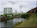
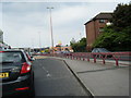
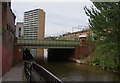
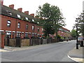
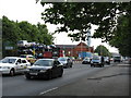
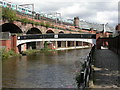
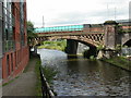
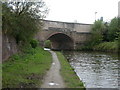
Photos of M5 4RS


Area Information
Living in M5 4RS means inhabiting a tightly packed residential cluster in England, where 1,330 people reside across just 3.3 hectares. The area’s density—nearly 40,000 people per square kilometre—reflects a compact, urban environment. It is a place defined by proximity to transport hubs and retail corridors, with Sainsburys Salford, Waitrose Little, and Co-op Salford within easy reach. The area’s character is shaped by its connectivity: rail stations like Deansgate and Salford Central sit within walking distance, while Cornbrook and Salford Quays metro stops provide swift access to Manchester’s broader network. Daily life here is punctuated by the rhythm of public transport, with City Airport Manchester just a short journey away. The community, dominated by young adults aged 15–29, thrives on convenience, though the high density and limited green space underscore the area’s compact, utilitarian nature. For those prioritising accessibility over space, M5 4RS offers a blend of practicality and urban vibrancy.
- Area Type
- Postcode
- Area Size
- 3.3 hectares
- Population
- 1330
- Population Density
- 3876 people/km²
The property market in M5 4RS is characterised by a high proportion of rental properties, with only 32% of households being owner-occupied. The accommodation type is almost exclusively flats, reflecting the area’s small size and high density. This suggests a limited housing stock, with few detached or semi-detached homes available. The compact nature of the area means property choices are constrained, and buyers may find competition fierce. The dominance of flats also implies a focus on short-term tenancies, with long-term ownership less common. For those seeking a home here, the market is likely to be geared towards renters rather than buyers, though the proximity to transport links and retail hubs may appeal to those prioritising convenience over space. The small area size means any property purchase would need to account for the limited local amenities and the need for external leisure options.
House Prices in M5 4RS
Showing 1 properties
| Address | Type | Beds | Baths | Last Sale Price | Last Sale Date | |
|---|---|---|---|---|---|---|
| Campanile Hotel, 55 Ordsall Lane, Salford, M5 4RS | retail_financial | - | - | - | - |
Energy Efficiency in M5 4RS
Residents of M5 4RS enjoy access to a range of retail and transport amenities within practical reach. The area is served by five retail outlets, including Sainsburys Salford, Co-op Salford, and Waitrose Little, ensuring everyday shopping needs are met. Transport options are extensive, with five metro stations, five rail stations, and a nearby bus stop connecting to Manchester’s broader network. The proximity to Salford Quays and Cornbrook metro stops offers easy access to leisure and cultural activities. While the area lacks dedicated parks or green spaces, its position near transport corridors and retail hubs means residents can quickly reach outdoor spaces in surrounding areas. The combination of retail, transport, and connectivity creates a lifestyle focused on convenience, though the compact footprint means local amenities are prioritised over expansive recreational areas.
Amenities
Schools
| Rank | School | Type | Entry gender | Ages |
|---|
Explore more schools in this area
Go to Schools tabDemographics
The population of M5 4RS is overwhelmingly young, with a median age of 22 and 64% of residents falling within the 15–29 age bracket. Only 32% of households are owner-occupied, indicating a rental-dominated market. The accommodation type is predominantly flats, reflecting the area’s high density and compact footprint. The predominant ethnic group is White, though specific data on diversity or deprivation is absent. The population density of 39,949 people per square kilometre is exceptionally high, comparable to major city centres. This density shapes daily life, fostering a fast-paced environment where proximity to amenities is both a benefit and a constraint. For residents, the lack of private space and reliance on shared infrastructure are defining features. The age profile suggests a transient community, with young professionals and students likely to dominate.
Household Size
Accommodation Type
Tenure
Ethnic Group
Religion
Household Composition
Age
Household Deprivation
NS-SEC
Explore more demographic insights in this area
Go to Demographics tabPlanning
Planning Constraints
- Flood RiskPremium
- Ramsar Wetland SitesPremium
- Area of Outstanding Natural BeautyPremium
- Protected Nature ReservePremium
- Protected WoodlandPremium