Area Overview for M5 4RD
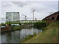
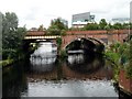
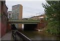
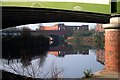
Photos of M5 4RD


Area Information
Living in M5 4RD means being part of a small, tightly knit residential cluster in England, home to 2,138 people. This area is defined by its compact size and proximity to urban hubs, offering a blend of local character and connectivity. The community is predominantly young, with a median age of 22 and most residents falling within the 15–29 age range. This demographic suggests a dynamic, often transient population, with many likely to be students or early-career professionals. The area’s housing stock is largely composed of houses, though home ownership is low at 16%, indicating a rental market. The absence of major planning constraints, such as protected woodlands or Areas of Outstanding Natural Beauty, means development is not restricted, though the high crime risk score of 0/100 raises practical concerns for residents. Nearby, the area benefits from access to primary schools, retail outlets, and transport links, making it a practical choice for those prioritising convenience over isolation. However, the compact nature of M5 4RD means its appeal is limited to those seeking proximity to larger cities without the full scale of urban life.
- Area Type
- Postcode
- Area Size
- Not available
- Population
- 2138
- Population Density
- 8329 people/km²
The property market in M5 4RD is characterised by a low home ownership rate of 16%, indicating that the majority of residents rent their homes. This suggests a rental market that may be competitive, particularly in a small area with limited housing stock. The accommodation type is predominantly houses, which could appeal to those seeking more space but may not align with the needs of younger or transient populations. Given the area’s compact size, buyers may need to look beyond M5 4RD for a broader range of properties. The low home ownership rate also implies that landlords may hold significant influence over the market, potentially affecting availability and affordability. For those considering purchasing, the small footprint of the area means proximity to amenities and transport is a key selling point, though the high crime risk score of 0/100 could be a deterrent for some buyers.
House Prices in M5 4RD
Showing 5 properties
| Address | Type | Beds | Baths | Last Sale Price | Last Sale Date | |
|---|---|---|---|---|---|---|
| Apartment 15, Bridgewater Point, Worrall Street, Salford, M5 4RD | Detached | 3 | 2 | - | - | |
| Apartment 11, Bridgewater Point, Worrall Street, Salford, M5 4RD | Retail | 3 | 2 | - | - | |
| Apartment 17, Bridgewater Point, Worrall Street, Salford, M5 4RD | Maisonette | 3 | 2 | - | - | |
| Apartment 13, Bridgewater Point, Worrall Street, Salford, M5 4RD | Maisonette | 3 | 1 | - | - | |
| Apartment 19, Bridgewater Point, Worrall Street, Salford, M5 4RD | Maisonette | 3 | 1 | - | - |
Energy Efficiency in M5 4RD
Life in M5 4RD is shaped by its proximity to retail, transport, and leisure hubs. Residents can access five retail outlets, including Co-op Salford, Co-op Cornbrook, and Waitrose Little, offering everyday shopping convenience. The area’s metro stations—Cornbrook, Pomona, and Salford Quays—alongside rail stations like Deansgate and Salford Central, provide easy access to urban centres. The nearby Chorlton Street Coach Station and Manchester City Airport further enhance connectivity. While the data does not specify parks or leisure facilities, the availability of multiple transport options and retail spaces suggests a lifestyle focused on practicality and accessibility. The compact nature of the area means that amenities are within practical reach, though residents may need to venture further for more specialised services. This mix of retail and transport infrastructure supports a daily rhythm that prioritises efficiency over isolation, ideal for those seeking convenience without urban density.
Amenities
Schools
Residents of M5 4RD have access to two nearby schools: Ordsall Community Nursery Centre, which provides early years education, and St Clement’s Egerton CofE Primary School, catering to primary-aged children. These institutions offer a foundation for families requiring nursery and primary schooling, though no secondary schools are listed in the data. The presence of both a nursery and primary school suggests that the area is suitable for young families, though parents may need to travel further for secondary education. The lack of additional schools in the immediate vicinity means that families should consider proximity to other educational institutions when planning their move. The mix of school types ensures that early education is accessible, but the absence of secondary options highlights a potential limitation for those prioritising a comprehensive local education system.
| Rank | School | Type | Entry gender | Ages |
|---|
Explore more schools in this area
Go to Schools tabDemographics
The population of M5 4RD is overwhelmingly young, with a median age of 22 and 16% of residents owning their homes. This suggests a community where renting is the norm, possibly reflecting student or transient populations. The most common age group, 15–29 years, aligns with areas near educational institutions or employment hubs. Accommodation here is primarily houses, not flats, which may appeal to those seeking more space. The predominant ethnic group is White, with no data provided on other demographics. The low home ownership rate implies a reliance on rental markets, which could impact long-term stability for residents. While no specific deprivation data is available, the high crime risk score of 0/100 suggests potential challenges in safety and quality of life. This profile paints a picture of a youthful, mobile population navigating a rental-heavy environment with limited social diversity.
Household Size
Accommodation Type
Tenure
Ethnic Group
Religion
Household Composition
Age
Household Deprivation
NS-SEC
Explore more demographic insights in this area
Go to Demographics tabPlanning
Planning Constraints
- Flood RiskPremium
- Ramsar Wetland SitesPremium
- Area of Outstanding Natural BeautyPremium
- Protected Nature ReservePremium
- Protected WoodlandPremium