Area Overview for M5 4NQ
Photos of M5 4NQ


Area Information
Living in M5 4NQ means inhabiting a compact, densely populated residential cluster in England’s north-west. Covering just 5.4 hectares, the area is home to 2,941 people, translating to a population density of 54,951 people per square kilometre. This small postcode is a microcosm of urban living, with a young demographic shaping its character. The median age of 22 suggests a community dominated by students, early-career professionals, and young families. Daily life here is defined by proximity to transport hubs and retail, with five rail stations within reach, including Salford Crescent and Salford Central. The area’s size means residents are likely to know their neighbours, though the high density also reflects the pressures of limited space. For those prioritising convenience over sprawling landscapes, M5 4NQ offers a tightly woven network of amenities, though its small footprint means every decision about living here is shaped by proximity to key services.
- Area Type
- Postcode
- Area Size
- 5.4 hectares
- Population
- 2941
- Population Density
- 4380 people/km²
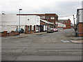
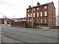
The property market in M5 4NQ is characterised by low home ownership, with just 22% of residents owning their homes. This suggests a rental market that dominates, likely driven by the area’s compact size and the presence of students and young professionals. The accommodation type is primarily houses, though the limited land area means these are probably small or semi-detached properties. The high population density indicates that the housing stock is tightly packed, with little scope for expansion. For buyers, this small area offers limited options, and the immediate surroundings may hold more variety. The low ownership rate also means competition for available properties, particularly among renters. Those considering purchase should factor in the area’s transient nature and the potential for rapid changes in the local market.
House Prices in M5 4NQ
Showing 27 properties
Energy Efficiency in M5 4NQ
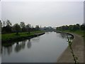
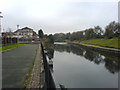
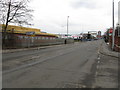
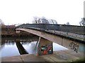
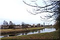
The lifestyle in M5 4NQ is shaped by its proximity to retail, transport, and urban hubs. Within walking distance are multiple shops, including Spar, Lidl Mocha, and Co-op Salford, offering everyday convenience. The area’s rail and metro stations, such as Salford Crescent and Victoria, provide easy access to Manchester’s cultural and commercial centres. City Airport Manchester is also nearby, catering to those with travel needs. While the data does not mention parks or leisure facilities, the density of transport options and retail suggests a practical, urban-oriented lifestyle. Residents can enjoy the vibrancy of nearby stations and the ease of commuting, though the lack of green spaces may be a drawback for those seeking more natural environments. The area’s compact nature means amenities are close, but its limitations in space and greenery are evident.
Amenities
Schools
| Rank | School | Type | Entry gender | Ages |
|---|
Explore more schools in this area
Go to Schools tabDemographics
The population of M5 4NQ is overwhelmingly young, with the median age at 22 and the most common age range being 15–29 years. This suggests a community skewed towards students, recent graduates, and young professionals. Only 22% of residents own their homes, indicating a rental-dominated market, which aligns with the area’s high population density. The predominant accommodation type is houses, though the limited space and high density suggest these are likely small properties. The predominant ethnic group is White, with no specific data on other groups provided. The low home ownership rate and young age profile imply a transient population, with many residents likely to move on as their circumstances change. This demographic profile shapes the area’s social fabric, with a focus on short-term housing needs and a reliance on shared spaces and communal amenities.
Household Size
Accommodation Type
Tenure
Ethnic Group
Religion
Household Composition
Age
Household Deprivation
NS-SEC
Explore more demographic insights in this area
Go to Demographics tabPlanning
Planning Constraints
- Flood RiskPremium
- Ramsar Wetland SitesPremium
- Area of Outstanding Natural BeautyPremium
- Protected Nature ReservePremium
- Protected WoodlandPremium