Area Overview for M5 4GS
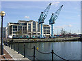
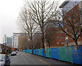
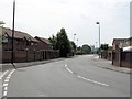
Photos of M5 4GS


Area Information
Living in M5 4GS means inhabiting a compact, densely populated postcode area in England. This small residential cluster covers 2,511 square metres and is home to 2,121 residents, creating a high population density of 844,536 people per square kilometre. The area’s character is defined by its proximity to urban infrastructure, with a mix of retail, transport, and leisure options within easy reach. The median age of 22 suggests a younger demographic, though the most common age range is adults aged 30–64, indicating a balance between young professionals and established households. Daily life here is shaped by its connectivity: multiple rail stations, metro stops, and retail hubs like Co-op Salford and Sainsburys Salford provide convenience. While the area lacks expansive green spaces, its proximity to MediaCityUK and surrounding amenities offers a blend of urban living and access to cultural or industrial sites. The compact nature of M5 4GS means residents are likely to know their neighbours, though the high density may also influence community dynamics. For buyers, this area is ideal for those prioritising accessibility over space, with a focus on proximity to transport and services.
- Area Type
- Postcode
- Area Size
- 2511 m²
- Population
- 2121
- Population Density
- 4141 people/km²
The property market in M5 4GS is characterised by low home ownership, with only 20% of residents owning their homes. This suggests a rental-dominated market, where flats are the primary accommodation type. The compact size of the area means housing stock is limited, with little scope for expansion or new developments. Flats, being the standard, likely cater to younger professionals or those prioritising proximity to transport and amenities over larger living spaces. Buyers should consider that competition for properties may be fierce, given the area’s small size and high density. The focus on rental properties implies that owner-occupiers may face challenges in securing long-term stability, particularly if the local economy shifts. For those seeking a home, the market offers limited options, but the proximity to rail stations, metro stops, and retail hubs could offset the lack of space. Potential buyers should also weigh the implications of high population density on property value and living conditions.
House Prices in M5 4GS
Showing 12 properties
| Address | Type | Beds | Baths | Last Sale Price | Last Sale Date | |
|---|---|---|---|---|---|---|
| 5 Rowland Street, Salford, M5 4GS | Terraced | 3 | 1 | £180,000 | Aug 2019 | |
| 3 Rowland Street, Salford, M5 4GS | Terraced | 3 | 1 | £138,000 | May 2019 | |
| 21 Rowland Street, Salford, M5 4GS | house | - | - | - | - | |
| 1 Rowland Street, Salford, M5 4GS | house | - | - | - | - | |
| 15 Rowland Street, Salford, M5 4GS | house | - | - | - | - | |
| 9 Rowland Street, Salford, M5 4GS | house | - | - | - | - | |
| 7 Rowland Street, Salford, M5 4GS | house | - | - | - | - | |
| 11 Rowland Street, Salford, M5 4GS | Terraced | - | - | - | - | |
| 19 Rowland Street, Salford, M5 4GS | house | - | - | - | - | |
| 23 Rowland Street, Salford, M5 4GS | house | - | - | - | - |
Energy Efficiency in M5 4GS
Residents of M5 4GS benefit from a range of amenities within practical reach. Retail options include major chains like Co-op Salford, Morrisons Daily, and Sainsburys Salford, ensuring everyday shopping needs are met. The area’s proximity to metro hubs such as Anchorage, Harbour City, and Broadway suggests access to leisure, dining, and cultural activities. Rail stations like Salford Crescent and Manchester United FC Railway Station provide links to wider destinations, while the nearby City Airport Manchester supports travel. The mix of retail, transport, and urban infrastructure creates a dynamic lifestyle, though the absence of detailed information on parks or recreational spaces means it is unclear whether green spaces are available. The compact nature of the area means amenities are concentrated, which can be convenient but may also lead to overcrowding in shared spaces. Overall, the lifestyle in M5 4GS is defined by accessibility and urban connectivity, with a focus on practicality over expansive leisure options.
Amenities
Schools
Residents of M5 4GS have access to two secondary schools: UTC@MediacityUK and AldridgeUTC@MediaCityUK. Both institutions are secondary in nature, catering to older students. AldridgeUTC@MediaCityUK holds a ‘good’ Ofsted rating, indicating a satisfactory standard of education. The absence of primary schools in the data suggests families may need to look beyond the immediate area for younger children’s education. The presence of two secondary schools offers some choice for families, though the lack of primary schools could be a drawback for those prioritising a full range of educational options. The schools’ locations near MediaCityUK may align with the area’s urban and industrial character, potentially offering specialised or vocational pathways. For parents, the availability of secondary education is a key consideration, though the need to travel for primary schooling may affect daily routines.
| Rank | School | Type | Entry gender | Ages |
|---|
Explore more schools in this area
Go to Schools tabDemographics
The community in M5 4GS is predominantly composed of adults aged 30–64, making up the most common age range. The median age of 22 suggests a younger population, possibly including students or early-career professionals. Home ownership is low, with only 20% of residents owning their homes, indicating that the majority rent. The accommodation type is primarily flats, reflecting a high-density living environment typical of urban areas. The predominant ethnic group is White, though no specific data on diversity or deprivation levels is provided. The high population density of 844,536 people per square kilometre implies a compact, possibly transient community. For quality of life, this density could mean efficient services and social interaction but may also lead to congestion or limited private space. The lack of data on deprivation means it is unclear whether this affects access to amenities or housing affordability. The area’s demographic profile suggests a focus on convenience and connectivity over traditional family-oriented living.
Household Size
Accommodation Type
Tenure
Ethnic Group
Religion
Household Composition
Age
Household Deprivation
NS-SEC
Explore more demographic insights in this area
Go to Demographics tabPlanning
Planning Constraints
- Flood RiskPremium
- Ramsar Wetland SitesPremium
- Area of Outstanding Natural BeautyPremium
- Protected Nature ReservePremium
- Protected WoodlandPremium