Area Overview for M5 4BB
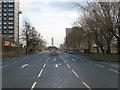
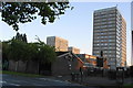
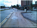
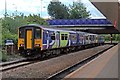
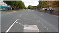
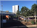
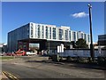
Photos of M5 4BB


Area Information
Living in M5 4BB means inhabiting a tightly packed residential cluster in England, where 2,442 people reside across 1,414 square metres. This density creates a compact, closely knit community, though it also means limited space for expansion. The area is defined by its proximity to essential services, with five retail outlets including Aldi Pendleton and Lidl Pendleton within practical reach. Public transport is robust, with multiple railway stations and metro stops nearby, linking residents to Manchester’s broader network. Daily life here is shaped by the presence of two primary schools and the high population density, which fosters a sense of familiarity among neighbours. However, the area’s small size means it is not suited for those seeking sprawling landscapes or large homes. For those prioritising convenience and connectivity, M5 4BB offers a blend of urban accessibility and residential simplicity, though its compact nature demands a tolerance for close quarters.
- Area Type
- Postcode
- Area Size
- 1414 m²
- Population
- 2442
- Population Density
- 4666 people/km²
The property market in M5 4BB is characterised by a low home ownership rate of 19%, indicating that the area is more rental-focused than owner-occupied. The accommodation type is primarily houses, which is atypical for a densely populated postcode. This suggests a mix of older, standalone properties, possibly with smaller gardens or shared spaces. Given the area’s size and the dominance of houses, the housing stock is limited, which may affect availability for buyers. The small footprint of M5 4BB means that properties are likely to be in close proximity to each other, with little scope for new developments. For buyers, this could mean competing for a limited number of homes, though the presence of multiple railway stations and retail outlets may offset the compact nature of the area. The market is likely to cater to those prioritising convenience over space.
House Prices in M5 4BB
Showing 5 properties
| Address | Type | Beds | Baths | Last Sale Price | Last Sale Date | |
|---|---|---|---|---|---|---|
| 1 Bala Close, Salford, M5 4BB | house | - | - | - | - | |
| 9 Bala Close, Salford, M5 4BB | house | - | - | - | - | |
| 5 Bala Close, Salford, M5 4BB | house | - | - | - | - | |
| 3 Bala Close, Salford, M5 4BB | house | - | - | - | - | |
| 7 Bala Close, Salford, M5 4BB | house | - | - | - | - |
Energy Efficiency in M5 4BB
Residents of M5 4BB enjoy a range of amenities within practical reach. Retail options include Aldi Pendleton, Lidl Pendleton, and Heron Pendleton, offering everyday shopping needs. The area’s transport network, with multiple railway stations and metro stops, ensures easy access to larger retail and leisure hubs. The presence of City Airport Manchester is a significant advantage for frequent travellers. While the data does not mention parks or leisure facilities, the compact nature of the area suggests that nearby green spaces may be limited. The focus on retail and transport infrastructure indicates a lifestyle prioritising convenience over expansive recreational areas. For those who value proximity to shops, transport, and airports, M5 4BB provides a practical, though compact, living environment.
Amenities
Schools
Residents of M5 4BB have access to two primary schools: West Liverpool Street Community Primary School and Lark Hill Community Primary School. The latter holds an Ofsted rating of ‘good’, which is a positive indicator for educational quality. The presence of two primary schools within the area suggests that families with young children can find local options, though the data does not mention secondary schools. This means parents may need to look beyond M5 4BB for secondary education. The availability of two primary schools, one with a strong rating, supports the area’s appeal for families. However, the absence of secondary schools could be a limitation for those planning long-term stays. The schools’ proximity to residential areas ensures that daily commutes for children are short, which is a practical advantage for working parents.
| Rank | School | Type | Entry gender | Ages |
|---|
Explore more schools in this area
Go to Schools tabDemographics
The median age in M5 4BB is 47, with the majority of residents falling into the 30–64 age range. This suggests a community skewed towards adults, likely with established careers and families. Home ownership is low at 19%, indicating that most households are renters rather than property owners. The accommodation type is predominantly houses, which is unusual for a densely populated area, suggesting a mix of older, standalone homes. The predominant ethnic group is White, reflecting a lack of demographic diversity. The high population density of 1,727,195 people per square kilometre implies shared spaces and limited private outdoor areas. This density can impact quality of life, increasing the demand for communal amenities and potentially straining local services. The data does not indicate significant deprivation, but the low home ownership rate may suggest economic pressures or a transient population.
Household Size
Accommodation Type
Tenure
Ethnic Group
Religion
Household Composition
Age
Household Deprivation
NS-SEC
Explore more demographic insights in this area
Go to Demographics tabPlanning
Planning Constraints
- Flood RiskPremium
- Ramsar Wetland SitesPremium
- Area of Outstanding Natural BeautyPremium
- Protected Nature ReservePremium
- Protected WoodlandPremium