Area Overview for M5 3SH
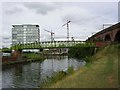
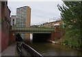
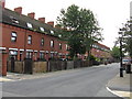
Photos of M5 3SH


Area Information
M5 3SH is a compact residential postcode area in England, covering just 1.4 hectares yet housing 1,813 residents. Its high population density of 128,156 people per square kilometre reflects a tightly packed community. This area is characterised by its proximity to urban infrastructure, with multiple metro, rail, and retail hubs within practical reach. Daily life here is shaped by the presence of nearby amenities such as Sainsburys Salford, Cornbrook metro station, and Salford Crescent Railway Station, which offer convenience for commuters and shoppers. The area’s small size means it is likely integrated into a larger urban fabric, with residents relying on public transport and nearby services. While the data does not specify historical context, the presence of multiple transport links and retail options suggests a functional, modern residential cluster catering to a young and mobile population.
- Area Type
- Postcode
- Area Size
- 1.4 hectares
- Population
- 1813
- Population Density
- 6524 people/km²
The property market in M5 3SH is primarily a rental market, with just 17% of residents owning their homes. The accommodation type is predominantly flats, reflecting a housing stock tailored to smaller households or individuals. This suggests limited availability of larger homes or owner-occupied properties, which could make the area less attractive to buyers seeking long-term investment. The small area size of 1.4 hectares further implies constrained housing development, potentially limiting options for those looking to purchase. For buyers, this means the area may be better suited to renters or those prioritising proximity to transport and amenities over property ownership. The focus on flats also indicates a need for consideration of shared spaces and potential noise from communal areas.
House Prices in M5 3SH
Showing 55 properties
| Address | Type | Beds | Baths | Last Sale Price | Last Sale Date | |
|---|---|---|---|---|---|---|
| 46 St Bartholomews Drive, Salford, M5 3SH | Flat | 1 | 1 | £110,000 | Nov 2022 | |
| 92 St Bartholomews Drive, Salford, M5 3SH | Terraced | 2 | 1 | £108,000 | Apr 2016 | |
| 73 St Bartholomews Drive, Salford, M5 3SH | Semi-detached | 2 | 1 | £95,000 | Mar 2013 | |
| 93 St Bartholomews Drive, Salford, M5 3SH | Terraced | - | - | £18,330 | Aug 2002 | |
| 83 St Bartholomews Drive, Salford, M5 3SH | house | - | - | - | - | |
| 85 St Bartholomews Drive, Salford, M5 3SH | Terraced | - | - | - | - | |
| 84 St Bartholomews Drive, Salford, M5 3SH | Terraced | - | - | - | - | |
| 82 St Bartholomews Drive, Salford, M5 3SH | Flat | - | - | - | - | |
| 91 St Bartholomews Drive, Salford, M5 3SH | house | - | - | - | - | |
| 94 St Bartholomews Drive, Salford, M5 3SH | house | - | - | - | - |
Energy Efficiency in M5 3SH
Living in M5 3SH provides access to a range of amenities within practical reach. Retail options include Sainsburys Salford, Waitrose Little, and Co-op Salford, offering everyday shopping needs. The area’s metro stations—such as Cornbrook and Anchorage—connect residents to Salford Quays, a major urban development with leisure and cultural facilities. Rail stations like Salford Central and Deansgate provide links to Manchester’s central business district. Proximity to City Airport Manchester adds convenience for frequent travellers. These amenities create a dynamic lifestyle, blending urban accessibility with local convenience. The density of services suggests a community that prioritises ease of movement, though the small area size may mean amenities are concentrated in specific zones.
Amenities
Schools
| Rank | School | Type | Entry gender | Ages |
|---|
Explore more schools in this area
Go to Schools tabDemographics
The community in M5 3SH is overwhelmingly young, with a median age of 22 and the majority of residents aged 15–29. This demographic profile indicates a population largely composed of students, young professionals, or those entering the workforce. Only 17% of residents own their homes, with flats being the predominant type of accommodation. This suggests a rental market dominated by tenants rather than homeowners. The predominant ethnic group is White, though the data does not provide further breakdowns of diversity. The high proportion of young adults may influence local culture, with social and economic activity centred around nearby amenities. However, the low home ownership rate could indicate limited long-term investment in property, which may affect perceptions of stability or community cohesion.
Household Size
Accommodation Type
Tenure
Ethnic Group
Religion
Household Composition
Age
Household Deprivation
NS-SEC
Explore more demographic insights in this area
Go to Demographics tabPlanning
Planning Constraints
- Flood RiskPremium
- Ramsar Wetland SitesPremium
- Area of Outstanding Natural BeautyPremium
- Protected Nature ReservePremium
- Protected WoodlandPremium