Area Overview for M5 3RQ
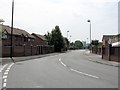
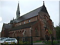
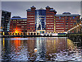
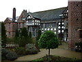
Photos of M5 3RQ


Area Information
Living in M5 3RQ means being part of a tightly packed residential cluster in England, where 2,138 people reside across just 6,547 square metres. This makes it one of the most densely populated areas in the country, with 326,553 people per square kilometre. The area’s compact size creates a sense of proximity to amenities, though it also means space is limited. Daily life here is shaped by its location near major transport hubs and retail centres, with residents within reach of Sainsburys Salford, Waitrose Little, and Co-op Salford. The community is young, with a median age of 22 and most residents aged 15–29. This demographic suggests a mix of students, young professionals, and families, though the low home ownership rate of 16% indicates a rental-dominated market. Despite its density, M5 3RQ lacks natural reserves or protected landscapes, focusing instead on urban connectivity. The area’s proximity to Salford Quays and City Airport Manchester ensures easy access to both local and regional opportunities, though the high crime risk reported in assessments warrants caution.
- Area Type
- Postcode
- Area Size
- 6547 m²
- Population
- 2138
- Population Density
- 8329 people/km²
The property market in M5 3RQ is characterised by low home ownership, with only 16% of residents owning their homes. This indicates a rental market dominated by private landlords or housing associations, rather than owner-occupied properties. The accommodation type is predominantly houses, though the small size of the postcode suggests a limited number of available homes. This scarcity may drive competition among renters, particularly for larger properties. For buyers, the area’s compact nature means the immediate surroundings are critical—any expansion in housing stock would likely come from nearby zones. The lack of data on property prices or availability means potential buyers must consider the broader regional market. Given the high population density and young demographic, the area may appeal to those seeking short-term rental solutions rather than long-term ownership.
House Prices in M5 3RQ
Showing 19 properties
| Address | Type | Beds | Baths | Last Sale Price | Last Sale Date | |
|---|---|---|---|---|---|---|
| 8 Regent Square, Salford, M5 3RQ | house | - | - | £175,000 | Apr 2017 | |
| 28 Regent Square, Salford, M5 3RQ | Terraced | 3 | - | £166,000 | Oct 2016 | |
| 34 Regent Square, Salford, M5 3RQ | Terraced | 3 | 1 | - | - | |
| 12 Regent Square, Salford, M5 3RQ | Terraced | 3 | 1 | - | - | |
| 2 Regent Square, Salford, M5 3RQ | house | - | - | - | - | |
| 20 Regent Square, Salford, M5 3RQ | Terraced | - | - | - | - | |
| 24 Regent Square, Salford, M5 3RQ | house | - | - | - | - | |
| 10 Regent Square, Salford, M5 3RQ | house | - | - | - | - | |
| 6 Regent Square, Salford, M5 3RQ | house | - | - | - | - | |
| 22 Regent Square, Salford, M5 3RQ | house | - | - | - | - |
Energy Efficiency in M5 3RQ
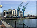
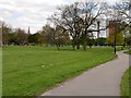
Residents of M5 3RQ enjoy a range of amenities within walking or short transit distance. Retail options include Sainsburys Salford, Waitrose Little, and Co-op Salford, offering daily essentials and groceries. The area’s proximity to metro stations like Cornbrook and Anchorage, along with rail links to Salford Crescent and Deansgate, ensures easy access to Manchester’s urban centres. For leisure, Salford Quays is a major nearby attraction, featuring dining, entertainment, and open spaces. The City Airport Manchester is also nearby, facilitating travel. While the data does not mention parks or green spaces, the absence of protected nature reserves or AONB coverage suggests a focus on urban living. The mix of retail, transport, and regional connectivity creates a dynamic lifestyle, though the compact size of the postcode may limit options for those seeking more expansive amenities.
Amenities
Schools
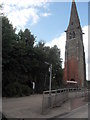
Residents of M5 3RQ have access to two schools within practical reach: Ordsall Community Nursery Centre and St Clement’s Egerton CofE Primary School. The nursery caters to early years education, while the primary school serves children aged 4–11. Together, they provide a seamless transition for families with young children, though no secondary schools are listed in the data. The absence of higher education institutions or secondary schools may require families to travel further for comprehensive schooling. The mix of state and faith-based education options reflects a diverse approach to learning, though the lack of data on Ofsted ratings or academic performance means parents must rely on local reputation or additional research. For those prioritising early education, the proximity of these schools is a clear advantage.
| Rank | School | Type | Entry gender | Ages |
|---|
Explore more schools in this area
Go to Schools tabDemographics
The community in M5 3RQ is overwhelmingly young, with a median age of 22 and 16% of residents owning their homes. This suggests a population skewed towards renters, possibly including students or transient workers. The most common age group is 15–29, reflecting a demographic that may prioritise affordability over long-term stability. Accommodation in the area is primarily houses, though the small size of the postcode implies limited housing stock. The predominant ethnic group is White, with no specific data provided on other communities. The high population density—326,553 people per square kilometre—raises questions about living conditions, though no data on deprivation or housing quality is available. For families, the area’s schools and transport links may be appealing, but the 16% home ownership rate suggests a reliance on rental properties, which could affect long-term investment prospects.
Household Size
Accommodation Type
Tenure
Ethnic Group
Religion
Household Composition
Age
Household Deprivation
NS-SEC
Explore more demographic insights in this area
Go to Demographics tabPlanning
Planning Constraints
- Flood RiskPremium
- Ramsar Wetland SitesPremium
- Area of Outstanding Natural BeautyPremium
- Protected Nature ReservePremium
- Protected WoodlandPremium