Area Overview for M5 3PJ
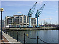
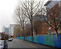
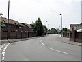
Photos of M5 3PJ


Area Information
M5 3PJ is a compact residential postcode in England, spanning just 1.8 hectares and home to 2,274 residents. Its high population density of 123,299 people per square kilometre reflects a tightly packed community, typical of urban clusters. The area is defined by its proximity to key infrastructure, including multiple railway stations and retail hubs. Daily life here is shaped by its small size and strategic location, offering easy access to larger urban centres like Manchester. The demographic profile suggests a mature population, with a median age of 47 and a majority of residents aged 30–64. This hints at a community with established families and professionals, though the low home ownership rate of 20% indicates a reliance on rental properties. Living in M5 3PJ means navigating a densely populated environment with limited green space, but the area’s connectivity and amenities make it a practical choice for those prioritising convenience over open space.
- Area Type
- Postcode
- Area Size
- 1.8 hectares
- Population
- 2274
- Population Density
- 6084 people/km²
The property market in M5 3PJ is characterised by a low home ownership rate of 20%, indicating that the majority of residents are likely renting. The accommodation type is primarily houses, which is unusual given the area’s high population density. This suggests a mix of small, densely packed properties, possibly terraced or semi-detached homes. The small size of the postcode—just 1.8 hectares—means the housing stock is limited, potentially making the area competitive for buyers. For those considering property in M5 3PJ, the focus would be on rental opportunities rather than long-term ownership. The lack of data on property prices or availability means buyers must approach the market cautiously, prioritising proximity to amenities and transport links over speculative investment. The area’s compact nature may also mean that immediate surroundings, such as nearby postcode clusters, hold more significant housing options.
House Prices in M5 3PJ
Showing 74 properties
| Address | Type | Beds | Baths | Last Sale Price | Last Sale Date | |
|---|---|---|---|---|---|---|
| 15 Phoebe Street, Salford, M5 3PJ | Flat | 2 | 1 | - | - | |
| 41 Wesley Green, Salford, M5 3PJ | undefined | - | - | - | - | |
| 40 Wesley Green, Salford, M5 3PJ | undefined | - | - | - | - | |
| 42 Wesley Green, Salford, M5 3PJ | undefined | - | - | - | - | |
| 2 Jennings Close, Salford, M5 3PJ | undefined | - | - | - | - | |
| 13 Wesley Green, Salford, M5 3PJ | undefined | - | - | - | - | |
| 11 Tamworth Walk, Salford, M5 3PJ | undefined | - | - | - | - | |
| 9 Wesley Green, Salford, M5 3PJ | undefined | - | - | - | - | |
| 19 Wesley Green, Salford, M5 3PJ | undefined | - | - | - | - | |
| 14 Wesley Green, Salford, M5 3PJ | undefined | - | - | - | - |
Energy Efficiency in M5 3PJ
The lifestyle in M5 3PJ is shaped by its proximity to retail, leisure, and transport hubs. Nearby shops include Morrisons Daily, Tesco Salford, and Co-op Salford, providing essential shopping options within easy reach. The area’s metro links to Anchorage, Salford Quays, and Harbour City suggest access to cultural and entertainment venues, though specific details about these locations are not provided. Rail stations offer connections to Manchester’s urban core, while the nearby City Airport Manchester enhances travel flexibility. Despite the compact size of the postcode, residents have access to a range of amenities, though the absence of parks or recreational spaces is notable. The character of the area is defined by its practicality, with daily life revolving around nearby services and transport links. This makes M5 3PJ suitable for those prioritising convenience over expansive green spaces.
Amenities
Schools
Residents of M5 3PJ have access to two primary schools with good Ofsted ratings: St Joseph’s RC Primary School and Primrose Hill Primary School and Children’s Centre. Both institutions are rated as good, offering families a reliable choice for early education. The presence of two primary schools within practical reach suggests a focus on supporting local families, though the data does not mention secondary schools in the area. This means parents may need to look further afield for secondary education, potentially impacting the appeal of M5 3PJ for families with older children. The good ratings for primary schools are a positive factor, but the absence of secondary options is a limitation that prospective buyers should consider when evaluating the area’s suitability for long-term family needs.
| Rank | School | Type | Entry gender | Ages |
|---|
Explore more schools in this area
Go to Schools tabDemographics
The population of M5 3PJ is predominantly adults aged 30–64, with a median age of 47. This suggests a community of middle-aged residents, likely established in their careers and family lives. Home ownership is low, with only 20% of households owning their homes, indicating a rental market that may cater to transient or younger occupants. The accommodation type is primarily houses, though the high population density of 123,299 per km² implies these homes are closely packed. The predominant ethnic group is White, with no data provided on other demographics. While this may reflect a homogenous community, the absence of diversity data means it is not possible to assess broader cultural or social composition. The age profile and ownership figures suggest a stable but not rapidly growing area, where residents may prioritise proximity to services over long-term investment in property.
Household Size
Accommodation Type
Tenure
Ethnic Group
Religion
Household Composition
Age
Household Deprivation
NS-SEC
Explore more demographic insights in this area
Go to Demographics tabPlanning
Planning Constraints
- Flood RiskPremium
- Ramsar Wetland SitesPremium
- Area of Outstanding Natural BeautyPremium
- Protected Nature ReservePremium
- Protected WoodlandPremium