Area Overview for M5 3NZ
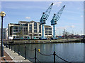
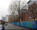
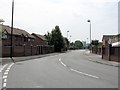
Photos of M5 3NZ


Area Information
Living in M5 3NZ means being part of a densely populated, compact residential cluster in England. The area covers just 1069 square metres, yet it accommodates 2271 residents, translating to a population density of over 2.1 million people per square kilometre. This small postcode area is characterised by a young demographic, with a median age of 22 and the most common age range being adults aged 30–64. Daily life here is shaped by proximity to retail hubs like Morrisons Daily and Tesco Salford, as well as transport links such as Salford Quays and Deansgate Railway Station. The area’s compact size means amenities are within practical reach, though the high population density may influence the pace of life. With no major natural constraints like AONB or protected woodlands, the area is focused on urban living, blending residential spaces with commercial and transport infrastructure. For buyers, the small footprint means properties are likely to be in close proximity to one another, with a mix of retail, leisure, and transport options defining the local character.
- Area Type
- Postcode
- Area Size
- 1069 m²
- Population
- 2271
- Population Density
- 3638 people/km²
The property market in M5 3NZ is defined by a low home ownership rate of 19%, suggesting that the majority of housing stock is rented out. Despite this, the accommodation type is listed as houses, which may indicate a mix of semi-detached or terraced properties typical of smaller urban areas. The small area size—just 1069 square metres—means the housing stock is likely concentrated, with limited scope for expansion. For buyers, this presents a challenge: the area’s compact nature and rental focus may mean competition for available properties, particularly given the high population density. However, the presence of nearby amenities like Salford Quays and Deansgate Railway Station could make it appealing for commuters or those seeking proximity to urban centres. The lack of significant planning constraints, such as AONB or protected woodlands, may also make it easier to navigate the property market without regulatory hurdles.
House Prices in M5 3NZ
Showing 11 properties
| Address | Type | Beds | Baths | Last Sale Price | Last Sale Date | |
|---|---|---|---|---|---|---|
| 1D Hulton Street, Salford, M5 3NZ | Maisonette | - | - | £186,950 | Mar 2019 | |
| 1E Hulton Street, Salford, M5 3NZ | Flat | - | - | £119,500 | Mar 2019 | |
| 1C Hulton Street, Salford, M5 3NZ | Maisonette | - | - | £186,950 | Mar 2019 | |
| 1F Hulton Street, Salford, M5 3NZ | Flat | - | - | £119,500 | Mar 2019 | |
| 1B Hulton Street, Salford, M5 3NZ | Flat | - | - | £119,500 | Mar 2019 | |
| 1L Hulton Street, Salford, M5 3NZ | Maisonette | - | - | £186,950 | Mar 2019 | |
| 1J Hulton Street, Salford, M5 3NZ | Flat | - | - | £119,500 | Mar 2019 | |
| 1A Hulton Street, Salford, M5 3NZ | Maisonette | - | - | £186,950 | Mar 2019 | |
| 1G Hulton Street, Salford, M5 3NZ | Maisonette | - | - | £186,950 | Mar 2019 | |
| 1H Hulton Street, Salford, M5 3NZ | Maisonette | - | - | £186,950 | Mar 2019 |
Energy Efficiency in M5 3NZ
The lifestyle in M5 3NZ is shaped by its proximity to retail, leisure, and transport hubs. Residents have access to five notable retail outlets, including Morrisons Daily and Tesco Salford, ensuring everyday shopping needs are met. The area’s connection to Salford Quays and Anchorage offers leisure and dining options, while nearby rail stations like Deansgate provide links to Manchester’s cultural and commercial centres. The presence of City Airport Manchester adds to the area’s accessibility, making it suitable for those with travel needs. Though the area is small, its integration with surrounding infrastructure ensures a balance between urban convenience and residential living. The compact size means amenities are closely clustered, reducing the need for long commutes. However, the limited number of bus stops and reliance on rail and metro services may influence the daily routine of residents.
Amenities
Schools
Residents of M5 3NZ have access to a range of educational institutions, including Markendale Nursery School, which provides early years education, and Radclyffe Community Primary School, catering to younger children. For secondary education, Oasis Academy MediaCityUK is a notable option, offering a good Ofsted rating. This mix of nursery, primary, and academy schools suggests a comprehensive educational ecosystem for families. The presence of a rated academy may be particularly appealing for parents seeking quality secondary education, though the absence of secondary schools within the postcode itself means students may need to commute. The proximity to Salford Quays and other transport hubs could ease travel to schools outside the immediate area. Overall, the school options reflect a focus on both early education and structured academic pathways.
| Rank | School | Type | Entry gender | Ages |
|---|
Explore more schools in this area
Go to Schools tabDemographics
The community in M5 3NZ is predominantly composed of adults aged 30–64, with a median age of 22, suggesting a mix of young professionals and families. Only 19% of residents own their homes, indicating a rental-dominated market, which may reflect the area’s transient nature. The predominant ethnic group is White, though no specific diversity metrics are provided. The high population density—over 2.1 million people per square kilometre—suggests a compact, possibly urbanised settlement. With 2271 residents in a small area, local services and amenities are likely to be heavily utilised. The age profile implies a balance between working-age adults and younger residents, potentially supporting a vibrant local economy. However, the low home ownership rate may indicate limited long-term investment in property, which could affect the area’s stability and community cohesion.
Household Size
Accommodation Type
Tenure
Ethnic Group
Religion
Household Composition
Age
Household Deprivation
NS-SEC
Explore more demographic insights in this area
Go to Demographics tabPlanning
Planning Constraints
- Flood RiskPremium
- Ramsar Wetland SitesPremium
- Area of Outstanding Natural BeautyPremium
- Protected Nature ReservePremium
- Protected WoodlandPremium