Area Overview for M46 9LF
Photos of M46 9LF
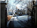
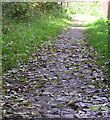
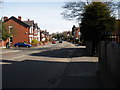
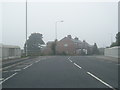

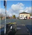
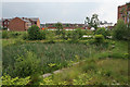
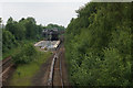
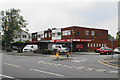
49 photos from this area
Area Information
Key information about the M46 9LF including its size, population, and administrative classification.
- Area Type
- Postcode
- Area Size
- 2.0 hectares
- Population
- 1389
- Population Density
- 2754 people/km²
House Prices in M46 9LF
20
Properties
£112,153
Average Sold Price
£38,000
Lowest Price
£195,000
Highest Price
Showing 20 properties
| Address | Type | Beds | Baths | Last Sale Price | Last Sale Date | |
|---|---|---|---|---|---|---|
| 176 Bolton Road, Atherton, M46 9LF | Terraced | 3 | 1 | £182,000 | Jan 2023 | |
| 164 Bolton Road, Atherton, M46 9LF | house | - | - | £124,995 | Apr 2022 | |
| 170 Bolton Road, Atherton, M46 9LF | Terraced | 3 | 1 | £195,000 | Feb 2022 | |
| 186 Bolton Road, Atherton, M46 9LF | Semi-detached | 3 | 1 | £179,950 | Nov 2021 | |
| 148 Bolton Road, Atherton, M46 9LF | house | - | - | £67,500 | May 2020 | |
| 162 Bolton Road, Atherton, M46 9LF | Terraced | 3 | 1 | £131,000 | Sep 2019 | |
| 158 Bolton Road, Atherton, M46 9LF | Terraced | 3 | 1 | £85,000 | May 2019 | |
| 156 Bolton Road, Atherton, M46 9LF | Terraced | 3 | 1 | £102,500 | Feb 2018 | |
| 168 Bolton Road, Atherton, M46 9LF | Terraced | 4 | 1 | £117,500 | Oct 2017 | |
| 172 Bolton Road, Atherton, M46 9LF | Terraced | 3 | - | £110,000 | Jul 2016 |
Page 1 of 2
Energy Efficiency in M46 9LF
Amenities
Schools
| Rank | School | Type | Entry gender | Ages |
|---|
Explore more schools in this area
Go to Schools tabDemographics
Household Size
Two person
most common
Accommodation Type
Houses
most common
Tenure
86
majority
Ethnic Group
White
most common
Religion
N/A
most common
Household Composition
N/A
most common
Age
47
median
Adults (30-64 years)
most common
Household Deprivation
N/A
with no deprivation
NS-SEC
32
in Lower managerial occupations
Explore more demographic insights in this area
Go to Demographics tabPlanning
Planning Constraints
- Flood RiskPremium
- Ramsar Wetland SitesPremium
- Area of Outstanding Natural BeautyPremium
- Protected Nature ReservePremium
- Protected WoodlandPremium