Area Overview for M46 9GN
Photos of M46 9GN


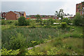
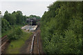
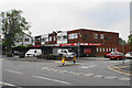
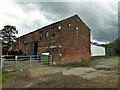
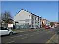
49 photos from this area
Area Information
Key information about the M46 9GN including its size, population, and administrative classification.
- Area Type
- Postcode
- Area Size
- 4674 m²
- Population
- 1389
- Population Density
- 2754 people/km²
House Prices in M46 9GN
14
Properties
£145,505
Average Sold Price
£42,000
Lowest Price
£275,000
Highest Price
Showing 14 properties
| Address | Type | Beds | Baths | Last Sale Price | Last Sale Date | |
|---|---|---|---|---|---|---|
| 3 Crosby Grove, Atherton, M46 9GN | Semi-detached | 3 | 1 | £185,000 | Jul 2025 | |
| 16 Crosby Grove, Atherton, M46 9GN | Bungalow | 3 | 2 | £275,000 | Dec 2023 | |
| 7 Crosby Grove, Atherton, M46 9GN | Bungalow | 3 | 1 | £180,000 | Sep 2023 | |
| 5 Crosby Grove, Atherton, M46 9GN | Bungalow | - | - | £135,666 | Apr 2023 | |
| 10 Crosby Grove, Atherton, M46 9GN | Semi-detached | 2 | 1 | £162,500 | Mar 2021 | |
| 2 Crosby Grove, Atherton, M46 9GN | Semi-detached | 4 | 2 | £214,950 | Nov 2019 | |
| 8 Crosby Grove, Atherton, M46 9GN | Semi-detached | 3 | - | £144,995 | Jul 2016 | |
| 9 Crosby Grove, Atherton, M46 9GN | Bungalow | - | - | £139,950 | Nov 2012 | |
| 12 Crosby Grove, Atherton, M46 9GN | Bungalow | - | - | £93,000 | Oct 2009 | |
| 4 Crosby Grove, Atherton, M46 9GN | Semi-detached | - | - | £110,000 | Apr 2008 |
Page 1 of 2
Energy Efficiency in M46 9GN
Amenities
Schools
| Rank | School | Type | Entry gender | Ages |
|---|
Explore more schools in this area
Go to Schools tabDemographics
Household Size
Two person
most common
Accommodation Type
Houses
most common
Tenure
86
majority
Ethnic Group
White
most common
Religion
N/A
most common
Household Composition
N/A
most common
Age
47
median
Adults (30-64 years)
most common
Household Deprivation
N/A
with no deprivation
NS-SEC
32
in Lower managerial occupations
Explore more demographic insights in this area
Go to Demographics tabPlanning
Planning Constraints
- Flood RiskPremium
- Ramsar Wetland SitesPremium
- Area of Outstanding Natural BeautyPremium
- Protected Nature ReservePremium
- Protected WoodlandPremium