Area Overview for M46 9AA
Photos of M46 9AA

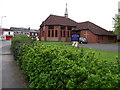
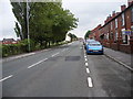
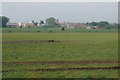


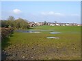

22 photos from this area
Area Information
Key information about the M46 9AA including its size, population, and administrative classification.
- Area Type
- Postcode
- Area Size
- 8138 m²
- Population
- 1500
- Population Density
- 2971 people/km²
House Prices in M46 9AA
35
Properties
£86,086
Average Sold Price
£15,000
Lowest Price
£175,000
Highest Price
Showing 35 properties
| Address | Type | Beds | Baths | Last Sale Price | Last Sale Date | |
|---|---|---|---|---|---|---|
| 117 Tyldesley Road, Atherton, M46 9AA | Terraced | 2 | 1 | £170,000 | Dec 2025 | |
| 113 Tyldesley Road, Atherton, M46 9AA | Terraced | 2 | 1 | £157,000 | Sep 2025 | |
| 139 Tyldesley Road, Atherton, M46 9AA | Terraced | 2 | 1 | £175,000 | Oct 2022 | |
| 157 Tyldesley Road, Atherton, M46 9AA | Bungalow | 2 | - | £159,500 | Jul 2021 | |
| 93 Tyldesley Road, Atherton, M46 9AA | house | 3 | 2 | £130,000 | Feb 2021 | |
| 91 Tyldesley Road, Atherton, M46 9AA | Detached | 3 | 2 | £150,000 | Jun 2019 | |
| 115 Tyldesley Road, Atherton, M46 9AA | house | - | - | £90,000 | Oct 2015 | |
| 153 Tyldesley Road, Atherton, M46 9AA | Terraced | 2 | 1 | £91,000 | Aug 2015 | |
| 131 Tyldesley Road, Atherton, M46 9AA | house | 3 | 1 | £99,950 | Dec 2014 | |
| 137 Tyldesley Road, Atherton, M46 9AA | Terraced | 2 | - | £88,000 | Sep 2014 |
Page 1 of 4
Energy Efficiency in M46 9AA
Amenities
Schools
| Rank | School | Type | Entry gender | Ages |
|---|
Explore more schools in this area
Go to Schools tabDemographics
Household Size
Two person
most common
Accommodation Type
Houses
most common
Tenure
81
majority
Ethnic Group
White
most common
Religion
N/A
most common
Household Composition
N/A
most common
Age
47
median
Adults (30-64 years)
most common
Household Deprivation
N/A
with no deprivation
NS-SEC
26
in Lower managerial occupations
Explore more demographic insights in this area
Go to Demographics tabPlanning
Planning Constraints
- Flood RiskPremium
- Ramsar Wetland SitesPremium
- Area of Outstanding Natural BeautyPremium
- Protected Nature ReservePremium
- Protected WoodlandPremium