Area Overview for M46 0PG
Photos of M46 0PG


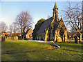

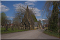
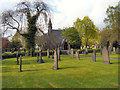
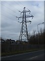
28 photos from this area
Area Information
Key information about the M46 0PG including its size, population, and administrative classification.
- Area Type
- Postcode
- Area Size
- 9192 m²
- Population
- 2120
- Population Density
- 1780 people/km²
House Prices in M46 0PG
15
Properties
£137,400
Average Sold Price
£45,000
Lowest Price
£210,000
Highest Price
Showing 15 properties
| Address | Type | Beds | Baths | Last Sale Price | Last Sale Date | |
|---|---|---|---|---|---|---|
| 8 Lovers Lane, Atherton, M46 0PG | Terraced | 2 | 1 | £188,000 | Dec 2024 | |
| 7A Lovers Lane, Atherton, M46 0PG | Terraced | 2 | 1 | £130,000 | Jul 2023 | |
| 7 Lovers Lane, Atherton, M46 0PG | Detached | 4 | 2 | £210,000 | Jul 2023 | |
| 3 Lovers Lane, Atherton, M46 0PG | Terraced | 2 | 1 | £137,500 | Aug 2022 | |
| 15 Lovers Lane, Atherton, M46 0PG | Bungalow | 2 | 1 | £175,000 | Jan 2022 | |
| 11 Lovers Lane, Atherton, M46 0PG | Detached | 3 | 1 | £208,500 | Jun 2017 | |
| 12 Lovers Lane, Atherton, M46 0PG | Terraced | 2 | 1 | £105,000 | Aug 2016 | |
| 9 Lovers Lane, Atherton, M46 0PG | Terraced | 3 | 1 | £95,000 | Mar 2014 | |
| 6 Lovers Lane, Atherton, M46 0PG | Terraced | 2 | 1 | £45,000 | Nov 2013 | |
| 1 Lovers Lane, Atherton, M46 0PG | Terraced | 2 | 1 | £80,000 | Apr 2007 |
Page 1 of 2
Energy Efficiency in M46 0PG
Amenities
Schools
| Rank | School | Type | Entry gender | Ages |
|---|
Explore more schools in this area
Go to Schools tabDemographics
Household Size
Two person
most common
Accommodation Type
Houses
most common
Tenure
79
majority
Ethnic Group
White
most common
Religion
N/A
most common
Household Composition
N/A
most common
Age
47
median
Adults (30-64 years)
most common
Household Deprivation
N/A
with no deprivation
NS-SEC
34
in Lower managerial occupations
Explore more demographic insights in this area
Go to Demographics tabPlanning
Planning Constraints
- Flood RiskPremium
- Ramsar Wetland SitesPremium
- Area of Outstanding Natural BeautyPremium
- Protected Nature ReservePremium
- Protected WoodlandPremium