Area Overview for M46 0LN
Photos of M46 0LN
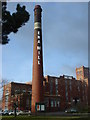
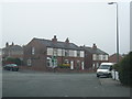
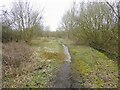
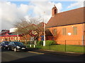

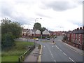
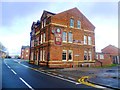

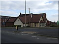


16 photos from this area
Area Information
Key information about the M46 0LN including its size, population, and administrative classification.
- Area Type
- Postcode
- Area Size
- 1.8 hectares
- Population
- 2629
- Population Density
- 1325 people/km²
House Prices in M46 0LN
38
Properties
£124,928
Average Sold Price
£25,000
Lowest Price
£200,000
Highest Price
Showing 38 properties
| Address | Type | Beds | Baths | Last Sale Price | Last Sale Date | |
|---|---|---|---|---|---|---|
| 176 Wigan Road, Atherton, M46 0LN | Semi-detached | 2 | 1 | £195,000 | Jul 2025 | |
| 180 Wigan Road, Atherton, M46 0LN | Semi-detached | 3 | 1 | £200,000 | Mar 2025 | |
| 164 Wigan Road, Atherton, M46 0LN | Semi-detached | 2 | 1 | £170,000 | Jan 2025 | |
| 158 Wigan Road, Atherton, M46 0LN | Semi-detached | 2 | 2 | £195,000 | Sep 2024 | |
| 90 Wigan Road, Atherton, M46 0LN | Terraced | 2 | 1 | £160,000 | Oct 2022 | |
| 178 Wigan Road, Atherton, M46 0LN | Retail | 2 | 1 | £160,000 | Sep 2022 | |
| 150 Wigan Road, Atherton, M46 0LN | Bungalow | 2 | 1 | £162,000 | Sep 2021 | |
| 192 Wigan Road, Atherton, M46 0LN | Terraced | 2 | 1 | £104,000 | Oct 2020 | |
| 142 Wigan Road, Atherton, M46 0LN | Semi-detached | 3 | 1 | £145,000 | Mar 2020 | |
| 190 Wigan Road, Atherton, M46 0LN | Terraced | 3 | 1 | £123,750 | Dec 2019 |
Page 1 of 4
Energy Efficiency in M46 0LN
Amenities
Schools
| Rank | School | Type | Entry gender | Ages |
|---|
Explore more schools in this area
Go to Schools tabDemographics
Household Size
Family (3-5 people)
most common
Accommodation Type
Houses
most common
Tenure
70
majority
Ethnic Group
White
most common
Religion
N/A
most common
Household Composition
N/A
most common
Age
47
median
Adults (30-64 years)
most common
Household Deprivation
N/A
with no deprivation
NS-SEC
33
in Lower managerial occupations
Explore more demographic insights in this area
Go to Demographics tabPlanning
Planning Constraints
- Flood RiskPremium
- Ramsar Wetland SitesPremium
- Area of Outstanding Natural BeautyPremium
- Protected Nature ReservePremium
- Protected WoodlandPremium