Area Overview for M46 0GN
Photos of M46 0GN
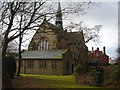
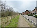
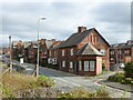
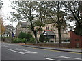


28 photos from this area
Area Information
Key information about the M46 0GN including its size, population, and administrative classification.
- Area Type
- Postcode
- Area Size
- 2.5 hectares
- Population
- 2120
- Population Density
- 1780 people/km²
House Prices in M46 0GN
66
Properties
£179,919
Average Sold Price
£67,500
Lowest Price
£280,000
Highest Price
Showing 66 properties
| Address | Type | Beds | Baths | Last Sale Price | Last Sale Date | |
|---|---|---|---|---|---|---|
| 35 Gadbury Fold, Atherton, M46 0GN | Flat | 2 | 2 | £122,500 | Sep 2025 | |
| 55 Gadbury Fold, Atherton, M46 0GN | Semi-detached | 3 | 3 | £208,000 | Mar 2025 | |
| 45 Gadbury Fold, Atherton, M46 0GN | Flat | 2 | 2 | £115,000 | Jan 2024 | |
| 21 Gadbury Fold, Atherton, M46 0GN | Flat | - | - | £67,500 | Nov 2023 | |
| 91 Gadbury Fold, Atherton, M46 0GN | Detached | 3 | 3 | £270,000 | Sep 2023 | |
| 47 Gadbury Fold, Atherton, M46 0GN | Flat | - | - | £100,500 | Jun 2023 | |
| 5 Gadbury Fold, Atherton, M46 0GN | Semi-detached | 3 | 3 | £250,000 | Mar 2023 | |
| 89 Gadbury Fold, Atherton, M46 0GN | Detached | 3 | 3 | £280,000 | Nov 2022 | |
| 103 Gadbury Fold, Atherton, M46 0GN | Detached | 4 | 4 | £275,000 | Dec 2021 | |
| 29 Gadbury Fold, Atherton, M46 0GN | Flat | 2 | 2 | £102,000 | Nov 2021 |
Page 1 of 7
Energy Efficiency in M46 0GN
Amenities
Schools
| Rank | School | Type | Entry gender | Ages |
|---|
Explore more schools in this area
Go to Schools tabDemographics
Household Size
Two person
most common
Accommodation Type
Houses
most common
Tenure
79
majority
Ethnic Group
White
most common
Religion
N/A
most common
Household Composition
N/A
most common
Age
47
median
Adults (30-64 years)
most common
Household Deprivation
N/A
with no deprivation
NS-SEC
34
in Lower managerial occupations
Explore more demographic insights in this area
Go to Demographics tabPlanning
Planning Constraints
- Flood RiskPremium
- Ramsar Wetland SitesPremium
- Area of Outstanding Natural BeautyPremium
- Protected Nature ReservePremium
- Protected WoodlandPremium