Area Overview for M46 0FD
Photos of M46 0FD
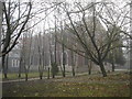

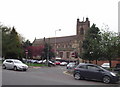
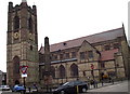
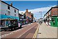

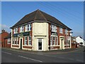
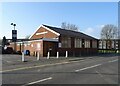
60 photos from this area
Area Information
Key information about the M46 0FD including its size, population, and administrative classification.
- Area Type
- Postcode
- Area Size
- 4994 m²
- Population
- 1676
- Population Density
- 1725 people/km²
House Prices in M46 0FD
23
Properties
£86,807
Average Sold Price
£22,800
Lowest Price
£135,000
Highest Price
Showing 23 properties
| Address | Type | Beds | Baths | Last Sale Price | Last Sale Date | |
|---|---|---|---|---|---|---|
| 78 Mealhouse Lane, Atherton, M46 0FD | Terraced | 3 | 2 | £125,000 | Jun 2025 | |
| 66 Mealhouse Lane, Atherton, M46 0FD | Terraced | 2 | 1 | £103,000 | Apr 2025 | |
| 80 Mealhouse Lane, Atherton, M46 0FD | Terraced | 2 | 1 | £117,000 | May 2024 | |
| 118 Mealhouse Lane, Atherton, M46 0FD | Terraced | 2 | 1 | £82,000 | Apr 2024 | |
| 124 Mealhouse Lane, Atherton, M46 0FD | Terraced | 3 | 1 | £135,000 | Nov 2023 | |
| 74 Mealhouse Lane, Atherton, M46 0FD | Retail | 2 | 1 | £118,000 | Nov 2022 | |
| 82 Mealhouse Lane, Atherton, M46 0FD | house | - | - | £118,000 | Feb 2022 | |
| 120 Mealhouse Lane, Atherton, M46 0FD | Terraced | 3 | 1 | £100,000 | Nov 2021 | |
| 76 Mealhouse Lane, Atherton, M46 0FD | Terraced | 3 | 3 | £85,500 | Jul 2016 | |
| 64 Mealhouse Lane, Atherton, M46 0FD | Terraced | 2 | 1 | £74,500 | Oct 2015 |
Page 1 of 3
Energy Efficiency in M46 0FD
Amenities
Schools
| Rank | School | Type | Entry gender | Ages |
|---|
Explore more schools in this area
Go to Schools tabDemographics
Household Size
One person
most common
Accommodation Type
Houses
most common
Tenure
50
majority
Ethnic Group
White
most common
Religion
N/A
most common
Household Composition
N/A
most common
Age
47
median
Adults (30-64 years)
most common
Household Deprivation
N/A
with no deprivation
NS-SEC
20
in Lower managerial occupations
Explore more demographic insights in this area
Go to Demographics tabPlanning
Planning Constraints
- Flood RiskPremium
- Ramsar Wetland SitesPremium
- Area of Outstanding Natural BeautyPremium
- Protected Nature ReservePremium
- Protected WoodlandPremium