Area Overview for M45 8XN
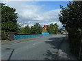
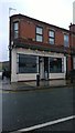
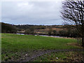
Photos of M45 8XN


Area Information
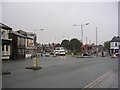
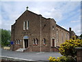
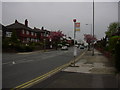
Living in M45 8XN means residing in a small, defined residential cluster within the Metropolitan Borough of Bury, Greater Manchester. The area, part of the village of Unsworth, sits on high ground between Parr Brook and Whittle Brook, historically a boggy arable landscape transformed by post-1950s urban development. With a population of 1,310, it is a compact community with a distinct character shaped by its proximity to the A56 arterial road and Sunny Bank Road, which links to Bury and Manchester. The area’s origins trace back to the 13th century, with a name derived from Old English, reflecting its medieval roots. Today, it is a quiet, low-density neighbourhood with a mix of residential housing and limited industrial heritage. Residents benefit from nearby transport links, including rail and bus services, and proximity to retail hubs. While the area is small, it offers a blend of historical context and modern connectivity, making it a niche choice for those seeking a settled, community-focused environment.
- Area Type
- Postcode
- Area Size
- Not available
- Population
- 1310
- Population Density
- 4771 people/km²
The property market in M45 8XN is characterised by a 40% home ownership rate, suggesting a significant portion of the housing stock is rented. The accommodation type is predominantly houses, which aligns with the low-density, suburban nature of the area. This mix implies a focus on family homes and semi-detached properties, typical of smaller residential clusters. Given the area’s small size and limited development, the housing stock is likely to be older, with potential for renovation or modernisation. For buyers, this means a niche market with limited new builds, but opportunities to acquire established homes with potential for improvement. The low home ownership rate may also indicate a rental market with demand for long-term lets, though specific data on property prices or availability is not provided. Prospective buyers should consider the area’s compact size and its proximity to transport links as key factors in assessing its appeal.
House Prices in M45 8XN
No properties found in this postcode.
Energy Efficiency in M45 8XN
The lifestyle in M45 8XN is shaped by its proximity to a range of amenities within practical reach. Retail options include Morrisons Whitefield, Co-op Parr, and Spar, offering everyday shopping needs. The area’s transport links, including rail stations and metro stops, connect residents to wider networks, while the A56 provides road access to Manchester and Bury. Though the data does not mention parks or leisure facilities, the presence of multiple retail and transport hubs suggests a convenience-focused lifestyle. The mix of shops, dining, and transport options supports a practical, community-oriented daily life, with minimal need to travel far for essentials. The area’s character is defined by its small-scale, residential nature, with amenities tailored to local needs rather than large-scale commercial developments.
Amenities
Schools
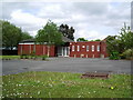
The schools near M45 8XN include St Bernadette’s Roman Catholic Primary School, Whitefield, and St Bernadette’s Roman Catholic Primary School, a Voluntary Academy, both offering primary education. Specialised provision is provided by Elms Bank Specialist Arts College and Elms Bank, both special schools catering to specific educational needs. The presence of both primary and special schools suggests a diverse educational landscape, accommodating a range of student requirements. For families, this mix means access to mainstream education alongside tailored support for students with additional needs. However, the absence of secondary schools in the immediate vicinity may require commuting for older children. The schools listed reflect a commitment to both general and specialist education, though no Ofsted ratings or performance data are available to assess their quality.
| Rank | School | Type | Entry gender | Ages |
|---|
Explore more schools in this area
Go to Schools tabDemographics
The community in M45 8XN is predominantly composed of adults aged 30–64, with a median age of 47. This suggests a mature, established population, likely with long-term ties to the area. Home ownership accounts for 40% of households, indicating a mix of owner-occupied and rental properties. The accommodation type is primarily houses, reflecting a low-density, suburban character. The predominant ethnic group is White, with no specific data provided on other demographics. The age profile and home ownership figures suggest a stable, middle-aged population with a focus on long-term residency. However, the relatively low home ownership rate may indicate a higher proportion of renters or shared housing. The absence of specific data on deprivation or diversity means the area’s social dynamics remain partially unexplored, but the demographic profile points to a community prioritising stability and family-oriented living.
Household Size
Accommodation Type
Tenure
Ethnic Group
Religion
Household Composition
Age
Household Deprivation
NS-SEC
Explore more demographic insights in this area
Go to Demographics tabPlanning
Planning Constraints
- Flood RiskPremium
- Ramsar Wetland SitesPremium
- Area of Outstanding Natural BeautyPremium
- Protected Nature ReservePremium
- Protected WoodlandPremium