Area Overview for M45 7NH
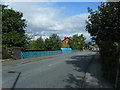
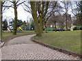
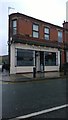
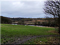
Photos of M45 7NH
Area Information
Living in M45 7NH means being part of a small, tightly knit residential cluster in England. With a population of just 1,421, the area feels intimate, offering a quiet contrast to larger urban centres. The community is predominantly composed of adults aged 30–64, reflecting a mature demographic that values stability. Most homes are owner-occupied, with 85% of residents living in houses rather than flats, suggesting a focus on family-friendly living. The area’s proximity to nearby towns like Whitefield, Besses o’th’barn, and Radcliffe ensures easy access to amenities while retaining a suburban feel. Digital connectivity is strong, with a broadband score of 95 and mobile coverage at 85, supporting remote work and daily internet use. However, the area’s safety profile is mixed: while flood risk is negligible, crime rates are above average, requiring residents to consider security measures. For those seeking a low-maintenance, family-oriented environment with practical infrastructure, M45 7NH offers a distinct blend of convenience and tranquillity.
- Area Type
- Postcode
- Area Size
- Not available
- Population
- 1421
- Population Density
- 3755 people/km²
The property market in M45 7NH is dominated by owner-occupied homes, with 85% of residents living in houses rather than flats or rental properties. This indicates a community prioritising long-term investment over transient tenancy. The absence of flats suggests a lack of high-density housing, which may limit options for buyers seeking smaller or more modern units. As a small area with a population of 1,421, the housing stock is likely limited to a few dozen properties, creating a competitive market for buyers. The focus on houses means the area is more suited to families or those requiring larger living spaces. Prospective buyers should consider the proximity to nearby towns like Whitefield and Radcliffe for additional property choices, though the immediate surroundings offer a cohesive, low-rise residential environment.
House Prices in M45 7NH
No properties found in this postcode.
Energy Efficiency in M45 7NH
The lifestyle in M45 7NH is shaped by its proximity to practical amenities. Retail options include Morrisons Whitefield, Aldi Whitefield, and Co-op Parr, offering everyday shopping needs. The area’s metro connections to Whitefield, Besses o’th’barn, and Radcliffe provide access to broader leisure and dining choices, though the immediate vicinity is more subdued. Rail and bus services ensure easy travel to nearby towns, while the lack of parks or recreational spaces within the postcode suggests outdoor activities may require venturing further afield. The combination of local shops and transport links creates a functional, low-key lifestyle, ideal for those prioritising convenience over sprawling amenities.
Amenities
Schools
The only school listed near M45 7NH is Whitefield Preparatory School, an independent institution. While the data does not include Ofsted ratings, the presence of an independent school suggests the area may attract families seeking private education. However, the absence of state schools or further education institutions in the immediate vicinity means families may need to look beyond the postcode for comprehensive schooling options. The single school type indicates a limited educational ecosystem, which could be a consideration for those prioritising a range of school choices. For households relying on state education, the nearest schools may be in nearby towns, requiring careful planning for commuting.
| Rank | School | Type | Entry gender | Ages |
|---|
Explore more schools in this area
Go to Schools tabDemographics
The population of M45 7NH is 1,421, with a median age of 47. This suggests a community of middle-aged adults, many of whom are likely in their peak earning years. The most common age range is 30–64, indicating a strong presence of families and established professionals. Home ownership is high at 85%, which aligns with the area’s focus on private residences rather than rental properties. All accommodation is in houses, not flats, reinforcing a suburban character. The predominant ethnic group is White, with no specific data on diversity beyond this. While the data does not include deprivation metrics, the high home ownership rate and age profile suggest a relatively stable socioeconomic environment. However, the lack of detailed diversity statistics means the community’s cultural composition remains unexplored in this context.
Household Size
Accommodation Type
Tenure
Ethnic Group
Religion
Household Composition
Age
Household Deprivation
NS-SEC
Explore more demographic insights in this area
Go to Demographics tabPlanning
Planning Constraints
- Flood RiskPremium
- Ramsar Wetland SitesPremium
- Area of Outstanding Natural BeautyPremium
- Protected Nature ReservePremium
- Protected WoodlandPremium