Area Overview for M45 7GP
Photos of M45 7GP
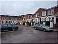
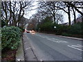
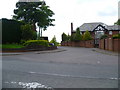
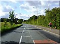

24 photos from this area
Area Information
Key information about the M45 7GP including its size, population, and administrative classification.
- Area Type
- Postcode
- Area Size
- 1.3 hectares
- Population
- 1462
- Population Density
- 393 people/km²
House Prices in M45 7GP
16
Properties
£469,906
Average Sold Price
£139,000
Lowest Price
£697,280
Highest Price
Showing 16 properties
| Address | Type | Beds | Baths | Last Sale Price | Last Sale Date | |
|---|---|---|---|---|---|---|
| 21 Ferndale Avenue, Whitefield, M45 7GP | Detached | 5 | 3 | £580,000 | Nov 2025 | |
| 5 Ferndale Avenue, Whitefield, M45 7GP | Retail | 2 | 2 | £540,000 | Sep 2023 | |
| 9 Ferndale Avenue, Whitefield, M45 7GP | house | - | - | £670,000 | Aug 2022 | |
| 31 Ferndale Avenue, Whitefield, M45 7GP | house | - | - | £580,000 | Aug 2022 | |
| 29 Ferndale Avenue, Whitefield, M45 7GP | Bungalow | 4 | 2 | £470,000 | Nov 2021 | |
| 25 Ferndale Avenue, Whitefield, M45 7GP | Bungalow | 2 | 1 | £660,000 | Dec 2019 | |
| 23 Ferndale Avenue, Whitefield, M45 7GP | Bungalow | 3 | 2 | £440,000 | Dec 2019 | |
| 27 Ferndale Avenue, Whitefield, M45 7GP | Bungalow | 2 | 1 | £350,000 | Oct 2019 | |
| 11 Ferndale Avenue, Whitefield, M45 7GP | Detached | 4 | 2 | £697,280 | Oct 2018 | |
| 3 Ferndale Avenue, Whitefield, M45 7GP | Bungalow | 4 | 3 | £350,000 | May 2017 |
Page 1 of 2
Energy Efficiency in M45 7GP
Amenities
Schools
| Rank | School | Type | Entry gender | Ages |
|---|
Explore more schools in this area
Go to Schools tabDemographics
Household Size
Two person
most common
Accommodation Type
Houses
most common
Tenure
89
majority
Ethnic Group
White
most common
Religion
N/A
most common
Household Composition
N/A
most common
Age
47
median
Adults (30-64 years)
most common
Household Deprivation
N/A
with no deprivation
NS-SEC
50
in Lower managerial occupations
Explore more demographic insights in this area
Go to Demographics tabPlanning
Planning Constraints
- Flood RiskPremium
- Ramsar Wetland SitesPremium
- Area of Outstanding Natural BeautyPremium
- Protected Nature ReservePremium
- Protected WoodlandPremium