Area Overview for M44 6WJ
Photos of M44 6WJ


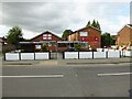


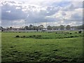
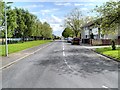

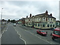
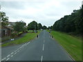
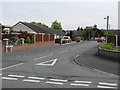
19 photos from this area
Area Information
Key information about the M44 6WJ including its size, population, and administrative classification.
- Area Type
- Postcode
- Area Size
- 8634 m²
- Population
- 1369
- Population Density
- 288 people/km²
House Prices in M44 6WJ
27
Properties
£135,888
Average Sold Price
£20,825
Lowest Price
£255,500
Highest Price
Showing 27 properties
| Address | Type | Beds | Baths | Last Sale Price | Last Sale Date | |
|---|---|---|---|---|---|---|
| 52 Sandy Lane, Irlam, M44 6WJ | Bungalow | 2 | 1 | £225,000 | Nov 2024 | |
| 68 Sandy Lane, Irlam, M44 6WJ | Semi-detached | 2 | 1 | £220,000 | Aug 2023 | |
| 27 Sandy Lane, Irlam, M44 6WJ | Semi-detached | 2 | 1 | £220,000 | May 2023 | |
| 54 Sandy Lane, Irlam, M44 6WJ | Retail | 2 | 1 | £194,000 | Jun 2022 | |
| 62 Sandy Lane, Irlam, M44 6WJ | Bungalow | 2 | 1 | £255,500 | May 2022 | |
| 49 Sandy Lane, Irlam, M44 6WJ | Bungalow | - | - | £205,000 | Feb 2022 | |
| 56 Sandy Lane, Irlam, M44 6WJ | Semi-detached | 2 | 1 | £243,000 | Dec 2021 | |
| 66 Sandy Lane, Irlam, M44 6WJ | Bungalow | - | - | £163,000 | Mar 2018 | |
| 64 Sandy Lane, Irlam, M44 6WJ | Bungalow | - | - | £119,000 | Mar 2018 | |
| 48 Sandy Lane, Irlam, M44 6WJ | Bungalow | - | - | £135,000 | Jun 2017 |
Page 1 of 3
Energy Efficiency in M44 6WJ
Amenities
Schools
| Rank | School | Type | Entry gender | Ages |
|---|
Explore more schools in this area
Go to Schools tabDemographics
Household Size
One person
most common
Accommodation Type
Houses
most common
Tenure
77
majority
Ethnic Group
White
most common
Religion
N/A
most common
Household Composition
N/A
most common
Age
47
median
Adults (30-64 years)
most common
Household Deprivation
N/A
with no deprivation
NS-SEC
27
in Lower managerial occupations
Explore more demographic insights in this area
Go to Demographics tabPlanning
Planning Constraints
- Flood RiskPremium
- Ramsar Wetland SitesPremium
- Area of Outstanding Natural BeautyPremium
- Protected Nature ReservePremium
- Protected WoodlandPremium