Area Overview for M44 6RB
Photos of M44 6RB
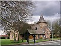
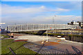
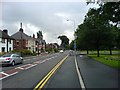
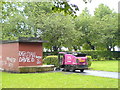
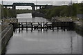
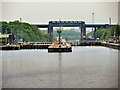
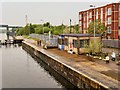
45 photos from this area
Area Information
Key information about the M44 6RB including its size, population, and administrative classification.
- Area Type
- Postcode
- Area Size
- 1.8 hectares
- Population
- 1363
- Population Density
- 2863 people/km²
House Prices in M44 6RB
29
Properties
£129,958
Average Sold Price
£57,950
Lowest Price
£340,000
Highest Price
Showing 29 properties
| Address | Type | Beds | Baths | Last Sale Price | Last Sale Date | |
|---|---|---|---|---|---|---|
| 16 Locklands Lane, Irlam, M44 6RB | house | - | - | £235,000 | Mar 2025 | |
| 18 Locklands Lane, Irlam, M44 6RB | house | 3 | 2 | £255,000 | Nov 2022 | |
| 20 Locklands Lane, Irlam, M44 6RB | Detached | 3 | - | £340,000 | Oct 2022 | |
| 9 Locklands Lane, Irlam, M44 6RB | house | - | - | £250,000 | Feb 2022 | |
| 12 Locklands Lane, Irlam, M44 6RB | Semi-detached | 3 | 2 | £164,700 | Jun 2020 | |
| 22 Locklands Lane, Irlam, M44 6RB | house | - | - | £275,000 | Aug 2018 | |
| 38 Locklands Lane, Irlam, M44 6RB | house | - | - | £240,000 | Jan 2017 | |
| 10 Locklands Lane, Irlam, M44 6RB | Detached | - | - | £191,500 | Jun 2008 | |
| 19 Locklands Lane, Irlam, M44 6RB | Detached | - | - | £126,500 | Dec 2001 | |
| 28 Locklands Lane, Irlam, M44 6RB | Semi-detached | - | - | £73,500 | Nov 2001 |
Page 1 of 3
Energy Efficiency in M44 6RB
Amenities
Schools
| Rank | School | Type | Entry gender | Ages |
|---|
Explore more schools in this area
Go to Schools tabDemographics
Household Size
Two person
most common
Accommodation Type
Houses
most common
Tenure
88
majority
Ethnic Group
White
most common
Religion
N/A
most common
Household Composition
N/A
most common
Age
47
median
Adults (30-64 years)
most common
Household Deprivation
N/A
with no deprivation
NS-SEC
32
in Lower managerial occupations
Explore more demographic insights in this area
Go to Demographics tabPlanning
Planning Constraints
- Flood RiskPremium
- Ramsar Wetland SitesPremium
- Area of Outstanding Natural BeautyPremium
- Protected Nature ReservePremium
- Protected WoodlandPremium