Area Overview for M44 6LL
Photos of M44 6LL
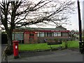

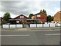
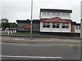
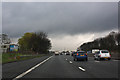

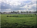
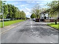
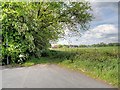
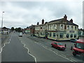
19 photos from this area
Area Information
Key information about the M44 6LL including its size, population, and administrative classification.
- Area Type
- Postcode
- Area Size
- 6617 m²
- Population
- 1516
- Population Density
- 7428 people/km²
House Prices in M44 6LL
23
Properties
£123,500
Average Sold Price
£95,000
Lowest Price
£152,000
Highest Price
Showing 23 properties
| Address | Type | Beds | Baths | Last Sale Price | Last Sale Date | |
|---|---|---|---|---|---|---|
| 102 Parkstone Road, Irlam, M44 6LL | Terraced | 3 | 1 | £152,000 | Aug 2025 | |
| 78 Parkstone Road, Irlam, M44 6LL | Terraced | - | - | £95,000 | Sep 2007 | |
| Former, 88 Parkstone Road, Irlam, M44 6LL | undefined | - | - | - | - | |
| 86B Parkstone Road, Irlam, M44 6LL | Flat | - | - | - | - | |
| 104 Parkstone Road, Irlam, M44 6LL | Maisonette | - | - | - | - | |
| 90 Parkstone Road, Irlam, M44 6LL | Terraced | - | - | - | - | |
| 94 Parkstone Road, Irlam, M44 6LL | house | - | - | - | - | |
| 98 Parkstone Road, Irlam, M44 6LL | house | - | - | - | - | |
| 96 Parkstone Road, Irlam, M44 6LL | house | - | - | - | - | |
| 74 Parkstone Road, Irlam, M44 6LL | house | - | - | - | - |
Page 1 of 3
Energy Efficiency in M44 6LL
Amenities
Schools
| Rank | School | Type | Entry gender | Ages |
|---|
Explore more schools in this area
Go to Schools tabDemographics
Household Size
Family (3-5 people)
most common
Accommodation Type
Houses
most common
Tenure
24
majority
Ethnic Group
White
most common
Religion
N/A
most common
Household Composition
N/A
most common
Age
22
median
Adults (30-64 years)
most common
Household Deprivation
N/A
with no deprivation
NS-SEC
13
in Lower managerial occupations
Explore more demographic insights in this area
Go to Demographics tabPlanning
Planning Constraints
- Flood RiskPremium
- Ramsar Wetland SitesPremium
- Area of Outstanding Natural BeautyPremium
- Protected Nature ReservePremium
- Protected WoodlandPremium